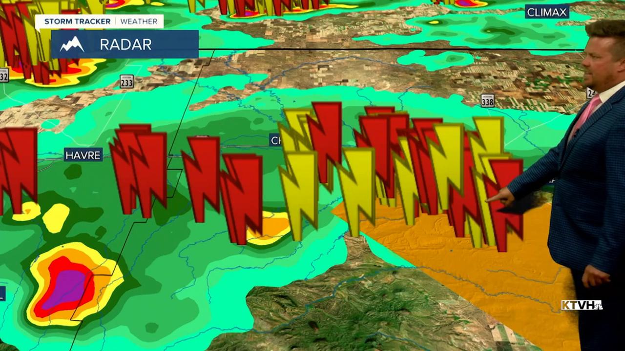


A SEVERE THUNDERSTORM WATCH has been issued for northern Montana through 10pm Thursday.
Severe thunderstorms have struck northern Montana with heavy rain, lots of lightning and large hail. A vigorous system will continue to bring storms through the evening to the Hi-Line. This system will move out through the night. Friday will be a pleasant mid summer day with highs in the 70s and 80s, and a few isolated thunderstorms could develop around southwest Montana late in the day. This weekend will be more like typical summer. Saturday will be warm and windy with highs in the 80s. A few strong storms are possible over far eastern Montana. Sunday will be slightly cooler with highs in the 70s and 80s and wind gusting to 25mph. A few isolated thunderstorms are possible late in the day. Early next week another July cooldown is likely with a good chance of moisture. Monday will turn mostly cloudy with scattered showers and thunderstorms. Highs will be back down in the 70s and 80s. Tuesday will also be mostly cloudy, cool, with widespread showers and thunderstorms. Wednesday will start to clear out with just a few lingering isolated thunderstorms. Temperatures will heat up a bit toward the final weekend of July.
Have a great day,
Curtis Grevenitz
Chief Meteorologist
