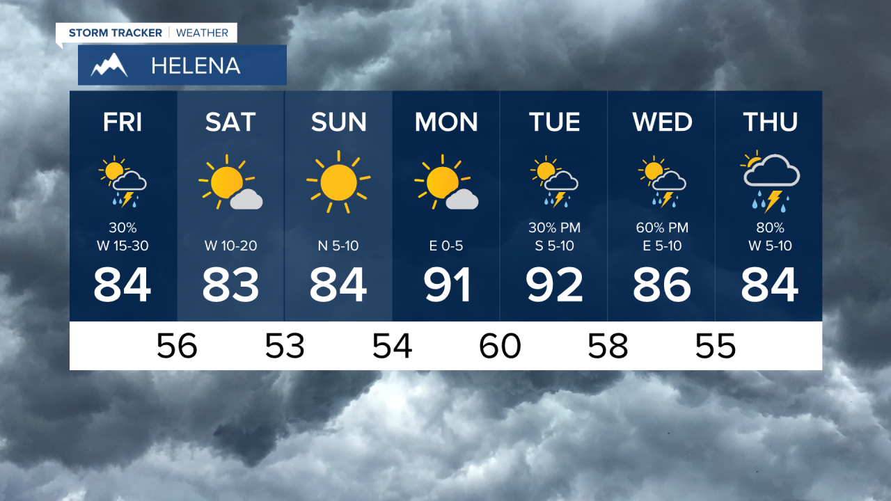
Thunderstorms have hit Montana hard on Thursday with lots of lightning but also some heavy downpours, even around the Jericho Mountain Fire. Friday will be partly cloudy with an isolated shower or thunderstorm possible in the morning and in the afternoon. Highs will top out near 80. The afternoon wind will intensify with gusts up to 30mph. This will be a big test for the activity on the Jericho Mountain Fire. Saturday will be mostly sunny with an outside chance at a storm but most of the state will be dry. Highs will be in the 70s to mid 80s. Once again the afternoon wind will pick up with some gusts topping 20mph. The storms dry up on Sunday with clear skies and highs staying comfortable in the 70s to around 80. Monday, the final day of June will have highs approaching 90. The beginning of July looks hot with temperatures in the 90s heading into Independence Day but some thunderstorm activity will continue.
Have a great day,
Curtis Grevenitz
Chief Meteorologist


