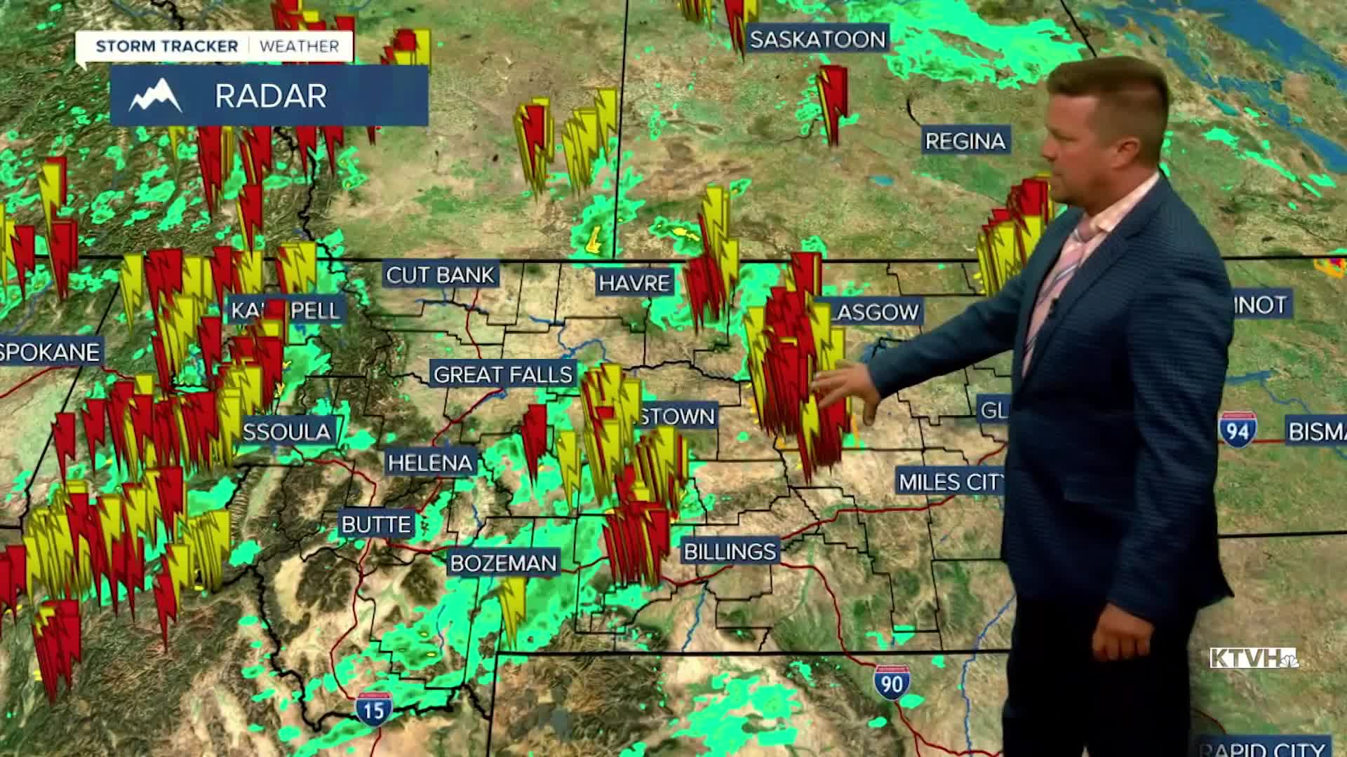


A SEVERE THUNDERSTORM WATCH continues for parts of eastern Montana through this late tonight.
Another summer storm system is moving through the state with strong to severe thunderstorms, heavy rain, a big drop in temperatures and some high mountain snow. Thunderstorms will continue to rumble across the state tonight and Friday. Some heavy rain could fall over wildfire burn scars causing flash flooding. There's a lot of upper level energy and cold air that is forcing these thunderstorms to develop. The upper cold pool has low enough temperatures that snow flakes will fly down below 9000' in some areas and some of the peaks could receive a coating up to a couple inches. Areas of heavy rain and high, high mountain snow will continue through the night into Friday morning. Friday will be partly to mostly cloudy with more clouds and showers across northern Montana. Some showers and storms will be scattered across most of the state through the afternoon and evening. Highs will be chilly in the 60s to low 70s, with 40s and 50s in the mountains. Strong wind will gust up over 30mph at times. The low pressure system will slowly move away Friday night into Saturday but a few showers will continue into Saturday afternoon. Gradually the airmass will warm and dry late on Saturday. Highs again will be cooler than average, mainly in the 70s to around 80. West wind could gust over 20mph. Sunday will be a much nicer day with mostly sunny skies and warmer temperatures in the 70s and 80s. Monday could hit 90 for some areas but another cold front will likely drop temperatures with a return of some storms by the middle of the week. This is the way the rest of summer should be with continued moisture and cooldowns.
Have a great day,
Curtis Grevenitz
Chief Meteorologist
