


A HIGH WIND WARNING is in effect for parts of Montana into Friday morning.
AN AVALANCHE WARNING is in effect for the Mission and Swan Mountains into Thursday afternoon.
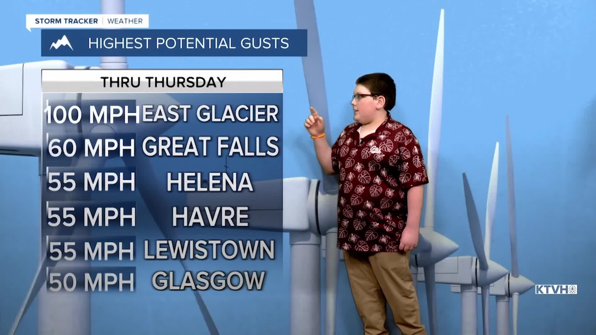
This latest round of powerful wind will continue through Thursday into Friday morning but will not be as severe as the wind storm that hit Montana in December. Still, some wind gusts could be as high as 100mph in the East Glacier area, along the Rocky Mountain Front and up near the Continental Divide. Wind gusts elsewhere will generally be between 50-60mph. The wind will continue through Thursday. This is when the strongest gusts up to near 100mph are possible along the Rocky Mountain Front. Thursday will be partly to mostly sunny with highs in the 40s to around 50. Strong wind will continue through Thursday night into Friday. The wind will slowly ease up on Friday as a cold front moves down from Canada into northern Montana. Snow will increase up on the Hi-Line through Friday evening. Some snow is possible in Great Falls and Lewistown, but most of the accumulation through Saturday morning will be up on the Hi-Line and across eastern Montana. Highs on Saturday will range from the 10s and 20s north, to the 40s farther south. Sunday will be a mostly sunny day with highs in the 30s and 40s. Sunday is also March 1st and that's the beginning of Meteorological Spring. Monday and Tuesday will be warmer and sunny with highs in the 50s.
Have a great day,
Curtis Grevenitz
Chief Meteorologist
