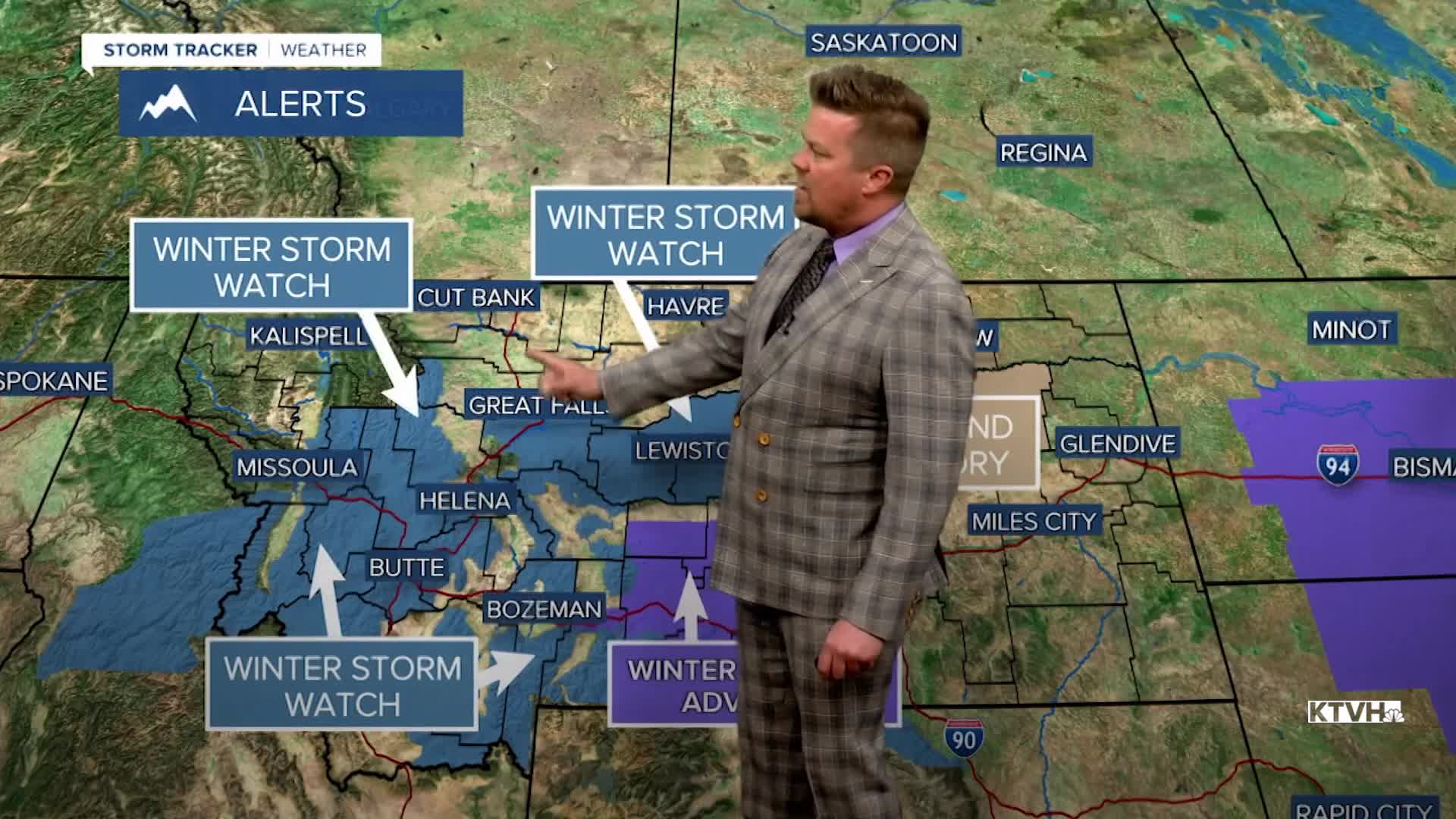


A WINTER STORM WATCH has been issued for parts of Montana for Thursday into Friday.
Tuesday is the last day of March and the first storm of April will bring a variety of weather from thunderstorms to heavy wet snow over the next few days. The unsettled weather will continue into the start of Easter holiday weekend on Good Friday, but the rest of the weekend should be pretty pleasant. The next storm system will move in Wednesday afternoon with some showers and isolated thunderstorms. Wednesday morning will be partly to mostly sunny ahead of the storm. Temperatures will be a bit warmer in the 50s for highs. Low pressure will move into the state on Thursday with widespread rain/snow in the lower elevations early on. Precipitation will change to snow for much of Montana by Thursday afternoon. Snow will continue through Thursday night into Friday. Right snow, the mountains could see 8-16" with a few to several inches accumulating in the lower elevations. Depending on elevation, about an inch or so could accumulate in lowest elevations, with as much as 6-8" just out adjacent to the mountains. Highs on Thursday will be in the 30s and 40s, but temperatures will fall along with the snow levels through the afternoon. Most of the snow will accumulate through Thursday night into Friday morning. Good Friday will start off on the colder side with snow and snow showers diminishing. There will be some sun through the afternoon, along with a few more mainly mountain snow showers. Saturday will be a pleasant day with partly cloudy to mostly sunny skies and highs in the 50s. Easter Sunday a weak front will come down from Canada with skies becoming partly to mostly cloudy along with an isolated afternoon shower. Most Easter egg hunts and morning services should be dry with temperatures in the 30s rising to the 50s to around 60 for highs. By Tuesday, temperatures should climb to near 70 degrees.
Have a great day,
Curtis Grevenitz
Chief Meteorologist
