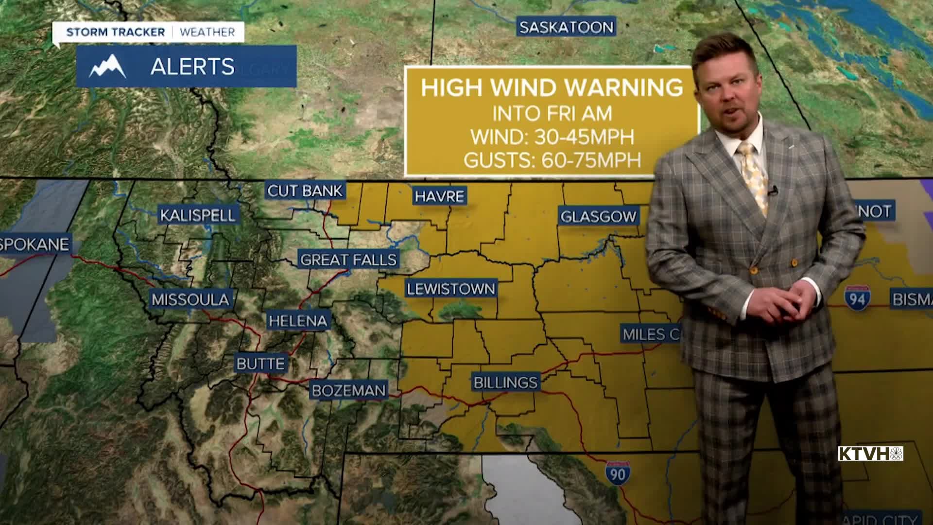


A HIGH WIND WARNING continues for central and eastern Montana into Friday morning.
After a few days of record warmth in January, the pattern is shifting, allowing temperatures to drop back closer to what you'd expect in Montana. Coming off of 3 straight days with record highs in the state, much of the West has been warm and dry so far this winter. A shift in the pattern is bringing a return of colder temperatures. Over the next several days, temperatures will be closer to average but exceptional cold and significant snow will still be absent. In the meantime, strong wind behind a cold front is making for a much colder feel across the state. Eastern Montana is where the strongest wind is and will be through Friday. Wind chills may drop below 0 there, which is cold but nothing unexpected for the time of year. High pressure will move in for Friday with mostly sunny and slightly cooler highs in the 20s and 30s. It's likely that most of Montana will be mostly sunny, closer to average temperatures, with wind across the plains through Martin Luther King Jr. holiday weekend. Saturday will be slightly warmer across the plains with a brief chinook wind developing. Highs will be in the 30s and 40s under mostly sunny skies. Sunday will be partly to mostly cloudy as another weak cold front moves through the state. Highs will dip back down into the 20s and 30s with a few isolated snow showers mainly over the mountains. Monday will be mostly sunny with highs in the 30s to near 40. A return to more typical snowy and cold weather will occur later next week around January 22nd or 23rd.
Have a great day,
Curtis Grevenitz
Chief Meteorologist
