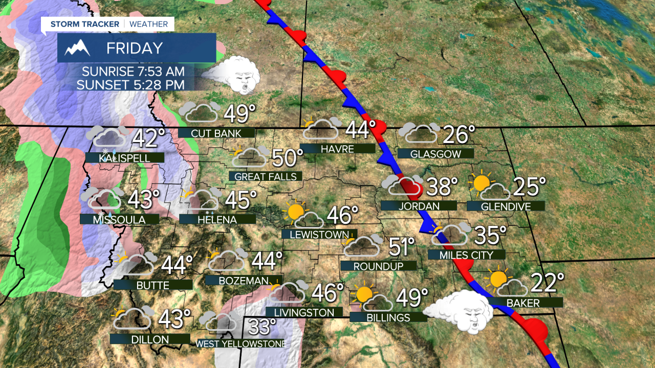
A weak system produced a little mountain snow in the state on Wednesday, with a little more light snow expected into the weekend. It's not much and there will not be any big snowstorms anytime soon. The mild and dry weather pattern will continue into February. It might not be until the middle of February before the weather pattern changes. Thursday will be partly cloudy with highs in the 30s and 40s, still a few 10s and 20s closer to the North Dakota border. Some snow will linger across far eastern Montana. Clouds will increase on Friday with a few mountain snow showers through the night into Saturday morning. Saturday will turn partly cloudy, windy and mild with highs in the 40s and 50s. Sunday will be mostly cloudy and mild with highs in the 40s and 50s. There will be a strong wind on the plains and over the Continental Divide. This pattern will likely continue through the first week of February. There are some indications around the 10-12th the pattern may shift with widespread snow coming through Montana and the West.
Have a great day,
Curtis Grevenitz
Chief Meteorologist


