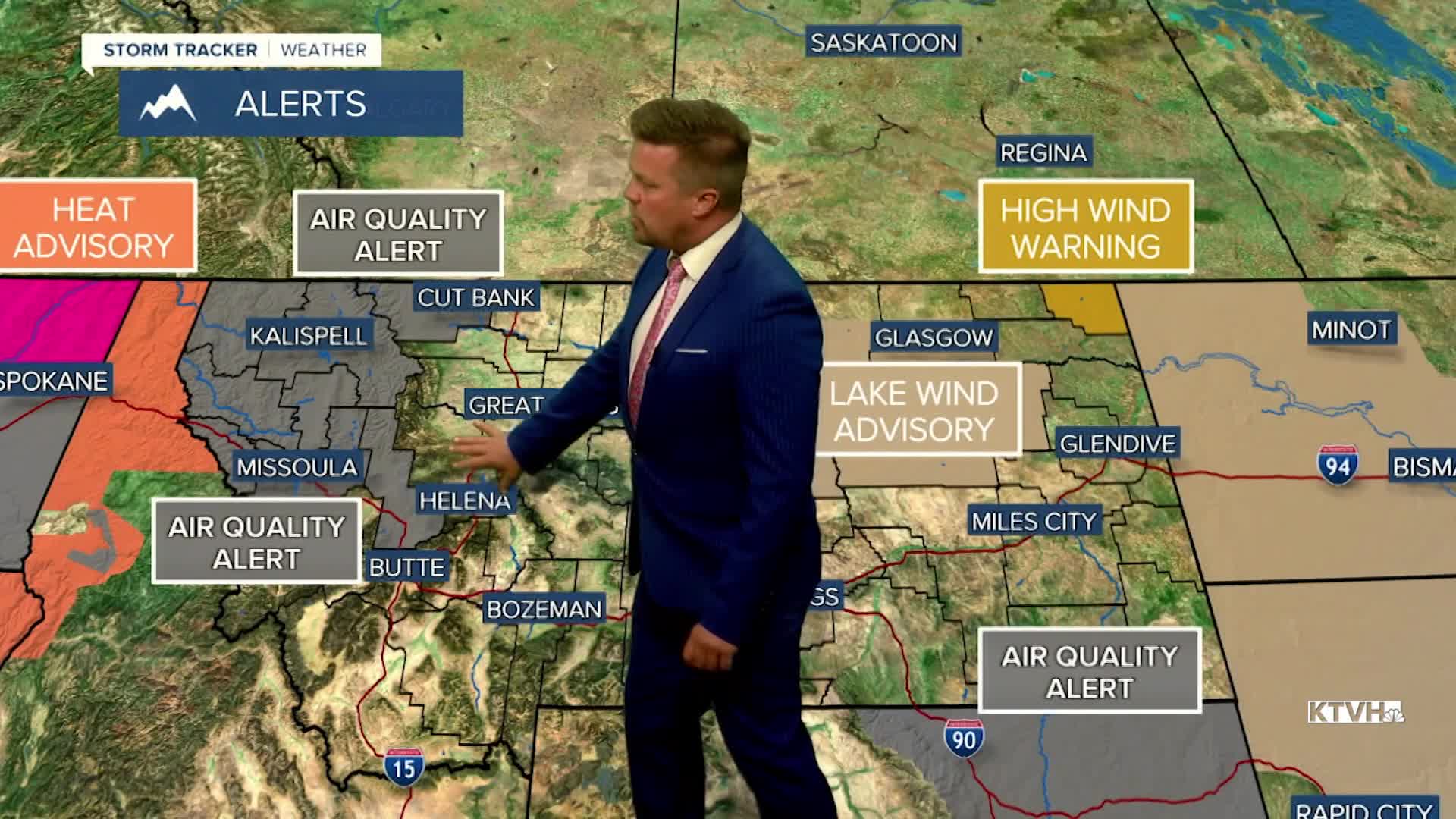


An AIR QUALITY ALERT is in effect for much of Montana west of the Continental Divide.
Thick smoke with the potential of unhealthy air will move into Montana through Wednesday night into Thursday morning. A Canadian cold front will move into Montana tonight with a high concentration of wildfire smoke. It may be best to sleep with windows closed and/or air conditioning on. The worst air quality will occur in the morning but this front will have a strong north wind that will push the worst smoke out of the area through the afternoon and evening. It will be much cooler with highs in the 60s and low 70s. North wind will gust up over 20mph at times. The wind will settle down and the air quality should be decent Thursday night. Canadian high pressure will build in with chilling temperatures falling into the 30s and low 40s for most of the state. Friday will be a pleasant day besides some lingering smoke with mostly sunny skies and temperatures feeling a bit more like fall. Highs will be in the 60s and low 70s again. The high pressure will continue into the weekend with mostly sunny to clear conditions on Saturday. A few thunderstorms may return to far western Montana on Saturday afternoon. The weather pattern will change with a return of some showers and storms through Sunday and Monday. The air quality should improve as well.
Curtis Grevenitz
Chief Meteorologist
