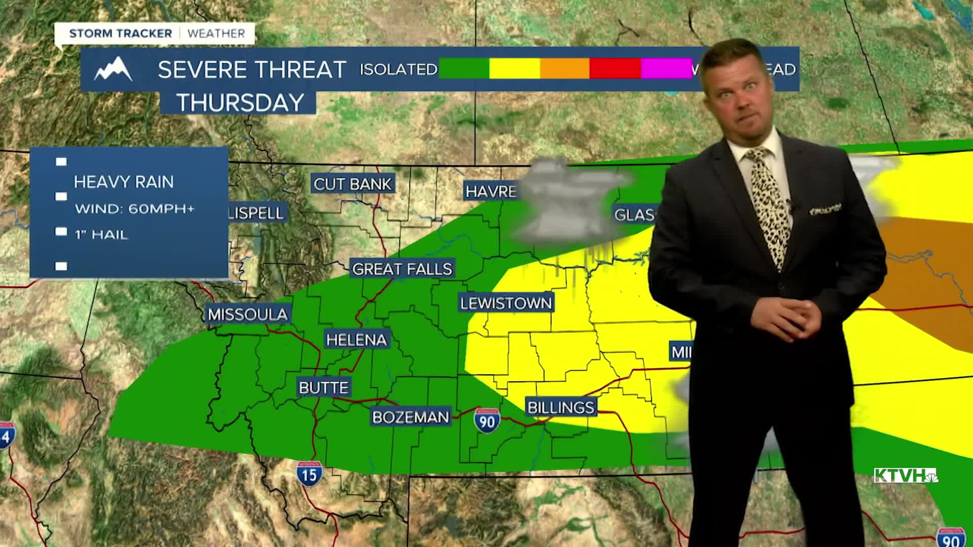


Strong to severe thunderstorms are likely across most of Montana on Thursday as yet another summer storm system will moves into the state. It's been a stormy summer and the pattern continues. An unusually strong and cold storm system will impact Montana through the rest of the week into the weekend. Widespread thunderstorms will work across Montana on Thursday. Some storms could contain large hail and damaging wind. Heavy downpours are likely again, so some areas could have some minor flooding. This storm system is cold enough that snow will fly in the mountains above 8000'. Highs will range from the 80s across eastern Montana, the 70s in the central parts of the state, with 60s in western Montana. Showers and thunderstorms and mountain snow will continue Thursday night into Friday. Friday will be a mostly cloudy day with areas of rain and a few isolated thunderstorms. Highs will be well below average in the 60s and 70s. There will be some clearing late Friday for places like Helena and Great Falls. Some showers will continue Friday night. Most of the state will be dry and partly cloudy on Saturday but a few showers will linger along the Hi-Line. Highs will warm into the 70s to around 80. Sunday will be a very nice day with mostly sunny skies and highs in the 70s and 80s.
Have a great day,
Curtis Grevenitz
Chief Meteorologist
