


Good Morning! Today is Wednesday, October 7, 2026.
Beautiful weather continues today and tomorrow as an upper-level ridge will be in complete control of our weather. Friday will still be a nice day, but the wind will pick up ahead of an approaching trough. A major pattern change is then expected this weekend as an upper-level trough moves into the Pacific Northwest, bringing much colder and wetter conditions to Montana.
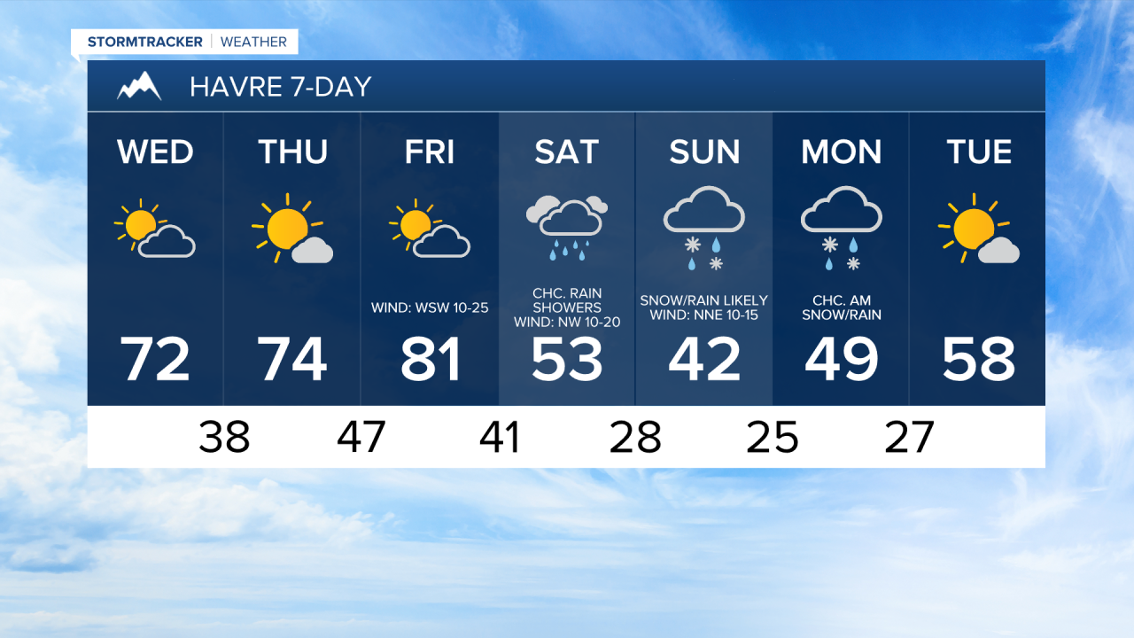
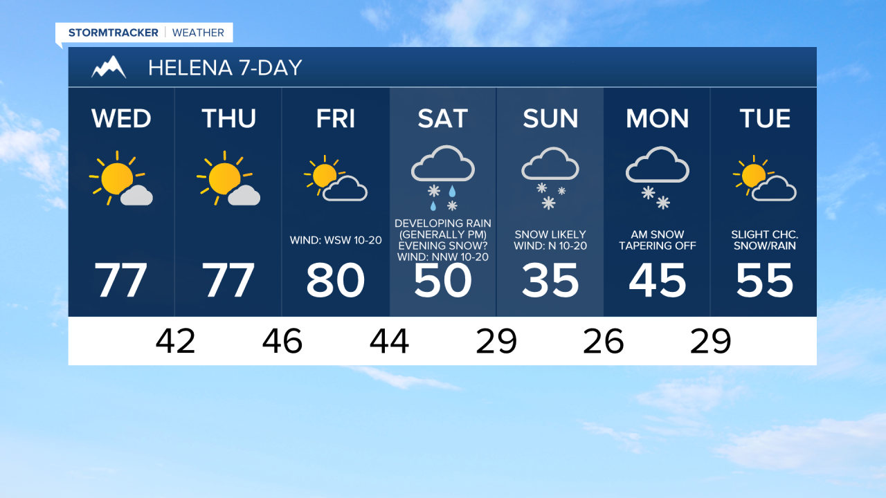
Today will be partly to mostly sunny, dry, and a little bit cooler with highs in the upper 60s and low to mid 70s. There will also be little to no wind around today. Tomorrow will be mostly sunny and dry, with increasing clouds during the afternoon and evening. The temperatures will warm back up tomorrow with highs in the 70s. It will also be breezy tomorrow along the Rocky Mountain Front with sustained winds of 10 to 25 mph. Elsewhere, there will be little to no wind around tomorrow.
Friday will be a warm day and likely the warmest day for the remainder of the year as highs will be in the mid to upper 70s and low to mid 80s. The wind will also pick up on Friday as the upper-level ridge departs our area and as an upper-level trough approaches our area. Along the Rocky Mountain Front, it will be windy on Friday, with sustained winds of 20 to 40 mph, and gusts up to 60 mph are possible. Elsewhere, gusty winds are expected on Friday, with sustained winds of 10 to 30 mph, and gusts over 40 mph are possible. Skies will be partly cloudy on Friday and it will remain dry.
A significant cooldown is expected this weekend, with Sunday being the coldest day since last spring. Highs on Saturday will only be in the 40s and low to mid 50s before dropping into the mid to upper 30s and low 40s on Sunday. Breezy conditions are also expected this weekend, with sustained winds of 10 to 20 mph, which will make it feel even colder.
Precipitation is expected to develop and become more widespread on Saturday as a storm system begins to impact the state. Widespread precipitation is then expected Saturday night and Sunday, with the precipitation tapering off some during the second part of Sunday.

Initially, precipitation will fall as rain in the lower elevations. However, snow levels are expected to drop behind a cold front late Saturday afternoon/evening and overnight, allowing rain to mix with snow or transition to all snow in the lower elevations. Snow levels will drop down to the plains and valley floors.
On Monday, some snow/rain is possible during the morning, but the precipitation will taper off and the skies will clear out as the day goes on. Tuesday will then be partly cloudy and mostly dry.
There remains considerable uncertainty regarding the exact track of this storm system, which will impact how much moisture will be available, how cold temperatures become, and how quickly the colder air arrives. Those factors will ultimately determine how low snow levels fall and how much snow accumulates.
At this time, accumulating snow is likely in the mountains, with over a half foot of snow expected. In the lower elevations, most areas will just receive a coating to a few inches of accumulation, but higher amounts are possible, especially in the foothills and northerly upslope regions of the mountains in central Montana.
Since it is October, a lot of the snow that initially falls will melt and it will be hard for snow to accumulate during the daylight hours. In the lower elevations, I expect the bulk of the accumulation to occur on grassy surfaces. I believe roads will primarily just remain wet. At and above mountain pass level, be prepared for difficult travel conditions at times this weekend, especially Saturday evening through Sunday morning. Stay tuned to KRTV/KXLH and KTVH/KTGF for the latest forecast updates.


Have a wonderful Wednesday!
Chief Meteorologist Ryan Dennis
