



Good Morning! Today is Friday, September 25, 2026. Here is today’s forecast:
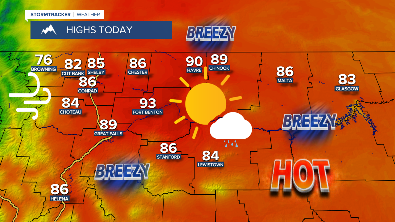
Summer-like weather is expected again today as high pressure remains in control. Expect mostly sunny to sunny skies and well above average temperatures for late September, with highs climbing into the upper 70s, 80s, and low 90s. For many locations, today will likely be the warmest day until next spring.
Clouds will begin to increase late this afternoon and evening as a cold front begins to move through the region. Most areas will remain dry, but a few showers and isolated thunderstorms are possible this evening and early tonight with the frontal passage. Skies will be partly cloudy to mostly clear overnight.
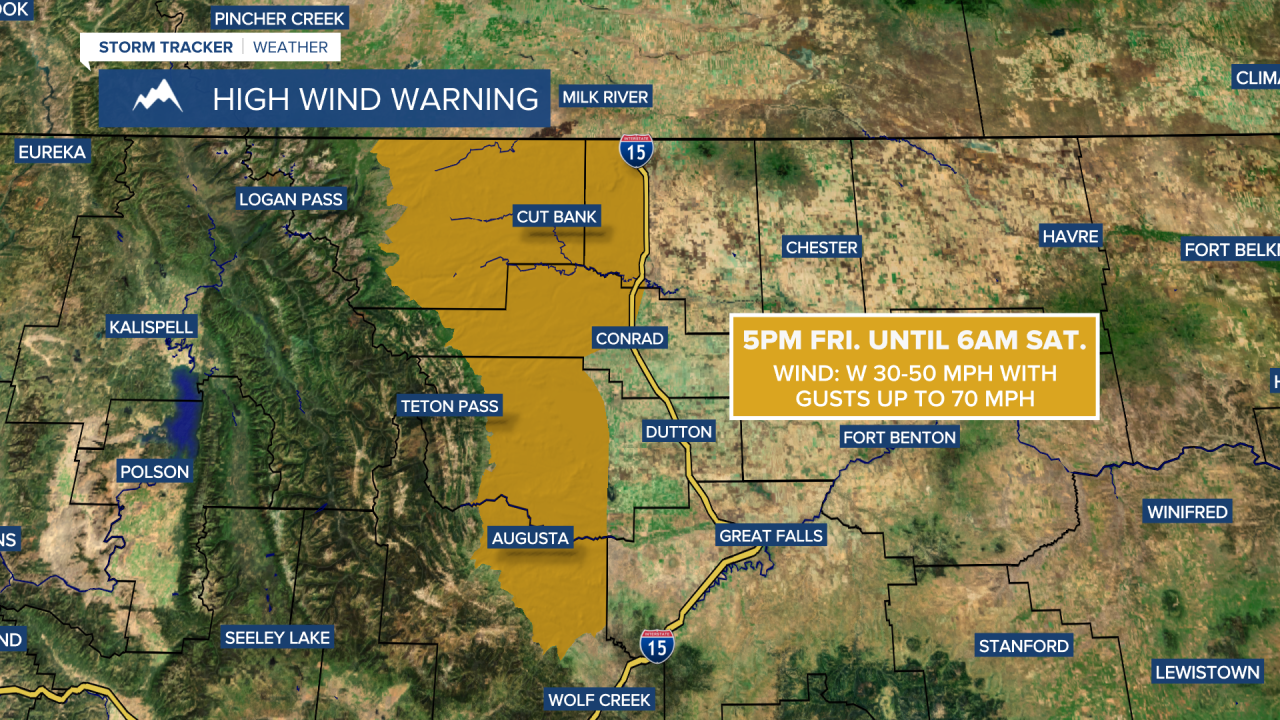
It will be breezy today, with sustained winds of 10 to 25 mph and gusts up to 40 mph possible. Widespread gusty winds are then expected this evening, tonight, and tomorrow. Sustained winds will range from 10 to 30 mph, and gusts over 40 mph are possible, especially this evening and tonight as the front passes through. The strongest winds will occur along the Rocky Mountain Front and around the Cut Bank/Shelby area, where gusts could reach 70 mph.
A HIGH WIND WARNING is in effect from 5pm today until 6am tomorrow for portions of Glacier, Lewis and Clark, Pondera, Teton and Toole counties.
A LAKE WIND ADVISORY is in effect for Fort Peck Lake from 8am today until 9am tomorrow.

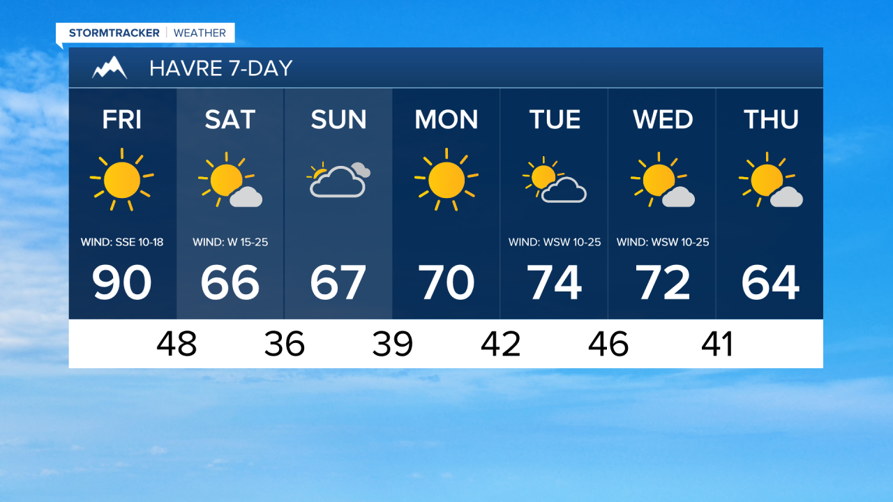
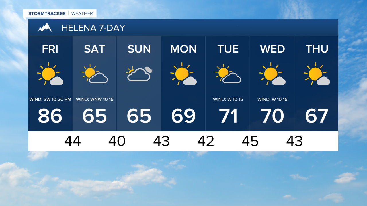
Tomorrow, it is going to be partly to mostly sunny and a lot cooler, with highs in the mid to upper 50s, 60s, and low 70s. Dry conditions are expected in most areas tomorrow, but there will be a little rain/snow in the Rockies, generally during the morning.
Winds will be noticeably lighter on Sunday, generally ranging from 5 to 15 mph. Temperatures will remain cool, with highs in the upper 50s and low to mid 60s. Skies will be mostly cloudy and it will be mostly dry.
High pressure will begin building back into the region on Monday, bringing mostly sunny skies and mostly dry weather. Temperatures will also begin to rebound, with highs returning to the mid to upper 60s and low 70s.
Pleasant fall weather is expected Tuesday through Thursday. Expect partly to mostly sunny skies, mainly dry conditions, and comfortable temperatures, with highs in the 60s and low to mid 70s, coolest on Thursday. Breezy conditions will develop again Tuesday and Wednesday, with sustained winds of 10 to 25 mph.


Have a fantastic Friday and an awesome weekend!
Chief Meteorologist Ryan Dennis
