

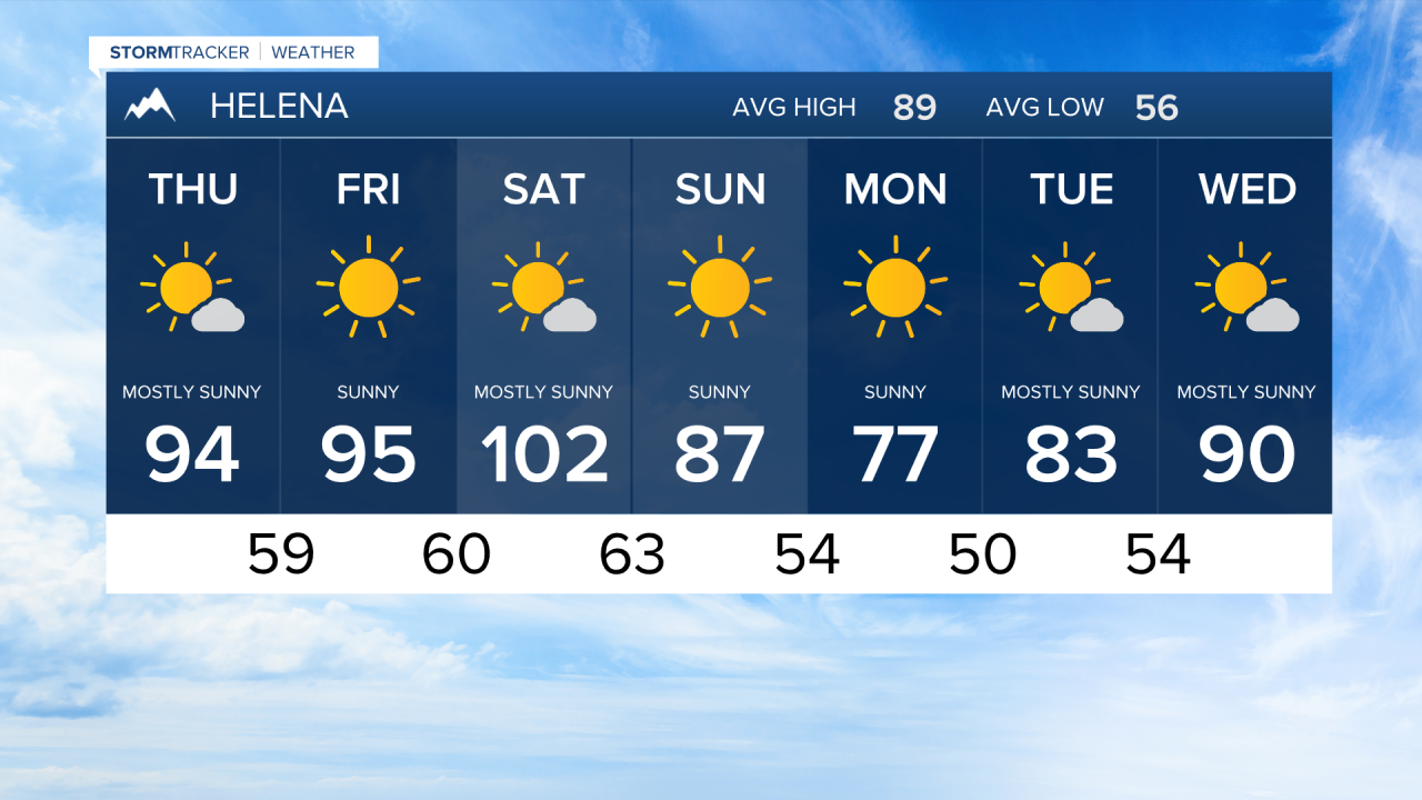

HELENA — A powerful ridge of high pressure will keep temperatures well above average across the Northern Rockies through Saturday, topping out with highs ranging from the mid-90s to nearly 110°F. Conditions remain mostly dry, though just enough moisture is slipping into Southwest and Central Montana to spark isolated showers and thunderstorms during the afternoons and evenings through Friday. The main hazard with any storm will be sudden, erratic wind gusts. By Saturday night, a strong storm system passing through Southern Canada will drag a dry cold front across the region, generating breezy conditions area-wide on Sunday and bringing a welcome drop in temperatures by Monday.
Forecast models are in firm agreement that Saturday will be the hottest day of the week, bringing extreme heat even by mid-summer standards. While wildfire smoke can occasionally shade the region and hold temperatures down, recent smoke has had little effect, boosting confidence in severe heat, particularly across the plains of Central and North Central Montana. Due to dangerous daytime highs and poor overnight recovery, an Extreme Heat Watch is in effect from Saturday afternoon through Sunday morning.
At the same time, exceptionally strong winds at higher levels will sweep over the Rocky Mountain Front from Saturday night into Sunday morning, strongest overnight between midnight and 8:00 AM. As these winds accelerate down the mountain slopes toward Cut Bank, hazardous surface gusts are likely. A High Wind Watch has been issued for Glacier County alongside western Toole and central Pondera Counties. Anyone planning to travel, camp, or hike in these areas should prepare for tough driving, falling trees in the backcountry, and elevated fire danger.
