


Good Morning! Today is Friday, September 4, 2026. Here is today’s forecast:
It is going to be partly to mostly sunny today, with more clouds around and west of I-15 and more sunshine east of I-15. Most locations will remain dry today, but there will be a few showers around the Helena area and in western portions of north-central Montana, generally during the evening.
A band of steadier rain will develop late tonight and persist through tomorrow morning across parts of Lewis and Clark, Teton, Pondera, Glacier, Toole, and Liberty counties. Outside of this area, there are only going to be a few showers around tonight and tomorrow morning, mainly across western portions of north-central Montana. There will then be some scattered showers and thunderstorms around tomorrow evening, generally in locations around and west of I-15.

It is also going to be partly to mostly cloudy tonight around and west of I-15 and it will be mostly clear tonight east of I-15. Tomorrow, it is going to be mostly cloudy along the Rocky Mountain Front, partly cloudy between the Front and I-15, and mostly sunny east of I-15.
Temperatures will vary considerably across the state today and tomorrow, with afternoon highs ranging from the low 60s along the Rocky Mountain Front to the mid 90s in northeastern Montana today and afternoon highs ranging from the upper 50s along the Rocky Mountain Front to the upper 80s in northeastern Montana tomorrow. There is also going to be a little breeze around on these two days as sustained wind speeds are going to be between 5 and 20 mph.
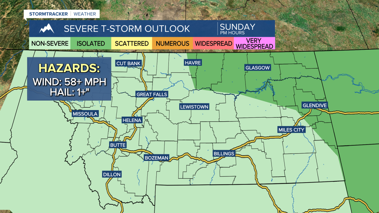
There will be some scattered showers and thunderstorms around on Sunday, generally during the afternoon and evening, as a storm system approaches our area. A few of the storms that develop on Sunday in locations east of I-15 may be severe with damaging winds (58+ mph) and/or large hail (1+” in diameter).
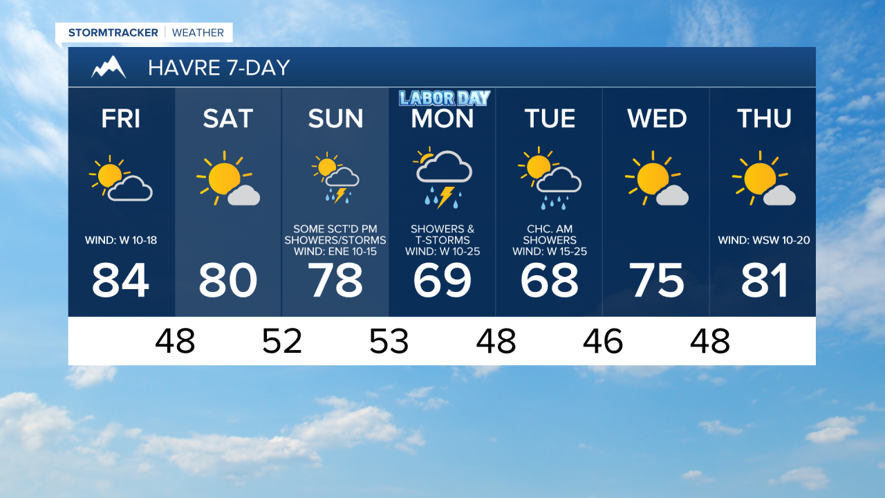
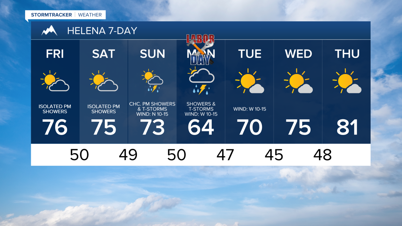
Showers and thunderstorms are then likely on Labor Day (Monday) as this storm system moves through the state. On Tuesday, it is going to be partly to mostly sunny and there will be a few lingering showers around during the morning, generally in locations east of I-15 and along the Hi-Line, as this storm system departs our area.
Cooler temperatures are expected from Sunday through Tuesday. On Sunday, highs are going to be in the 60s, 70s, and low to mid 80s, with the warmest temperatures in northeastern Montana. Highs are then going to be in the mid to upper 50s, 60s, and low 70s on Monday and the 60s on Tuesday. There is also going to be a bit of a breeze around on Monday as sustained wind speeds are going to be between 10 and 20 mph. It is then going to be gusty on Tuesday as sustained wind speeds are going to be between 10 and 30 mph, and wind gusts over 40 mph are possible.
Beautiful weather will return for Wednesday and Thursday as high pressure will be in control of our weather. On these two days, it is going to be mostly sunny and mostly dry. The temperatures will also warm back up over these two days as highs are going to be in the 70s on Wednesday and the mid to upper 70s and low to mid 80s on Thursday. There is also going to be a bit of a breeze around on Thursday as sustained wind speeds are going to be between 10 and 20 mph.



Have a fantastic Friday and a fun Labor Day weekend!
Chief Meteorologist Ryan Dennis
