

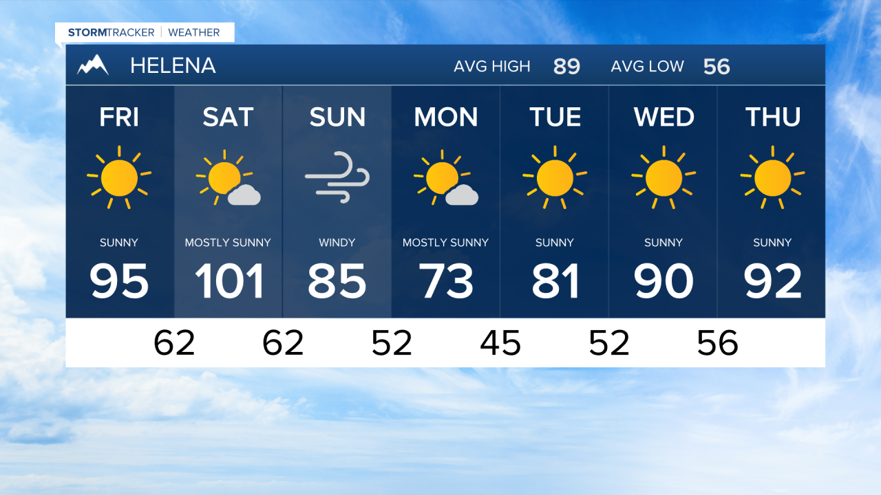

HELENA — High pressure aloft will hold strong through Saturday, keeping unseasonably hot conditions locked in across the area. Highs will top out Saturday afternoon between the mid-90s to low 100s. Overnight lows won't offer much relief on top of the scorching daytime heat.
The pattern begins to shift Saturday night as a upper-level disturbance tracks across Southern Canada, knocking down the ridge. It will push a cold front through the region, bringing widespread gusty winds on Sunday and dropping temperatures below average for Monday before we heat right back up.
Along with the front, powerful winds aloft will crash over the Rocky Mountain Front and push eastward Saturday night into Sunday morning. A High Wind Watch will be in effect from Saturday afternoon through Sunday evening, with the strongest winds expected between midnight and 8 AM Sunday morning. If you're heading toward the front, plan for tough driving and hiking conditions. Keep in mind these strong gusts could quickly spread any active or fresh wildfires.
On that note, due to the strong winds, hot temperatures, and low humidity, a Fire Weather Watch will be in effect Saturday afternoon through Sunday evening.
