


Good Morning! Today is Friday, September 18, 2026.
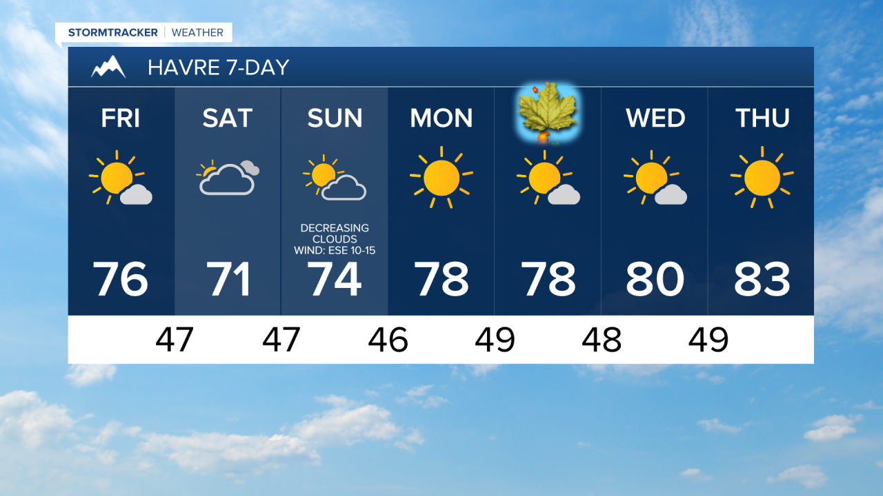
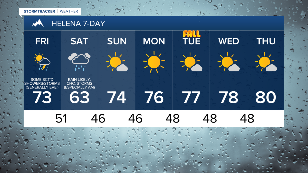
Another nice day ahead for north-central Montana. It is going to be partly cloudy, with the cloud cover increasing throughout the day. Most locations will be dry, but a few isolated showers/storms are possible, mainly during the afternoon/evening and mainly in southern portions of north-central Montana. Around Helena, it is going to be partly to mostly cloudy today and there are going to be some scattered showers and thunderstorms around, generally during the late afternoon and evening. Highs today will be in the 70s and upper 60s in most locations.
Scattered showers and thunderstorms are expected tonight around the Helena area and in portions of Cascade County, Judith Basin County, and Fergus County, with a steadier rain developing during the second half of the night. Rain is likely tomorrow morning in these same areas. That rain will then taper off into some scattered showers for the afternoon and evening. Some of the rain that falls tonight and tomorrow may be heavy at times.
Most of north-central Montana will remain dry tonight and tomorrow as the bulk of the rain will remain south of a Great Falls to Stanford to Roy line. Skies tonight and tomorrow will be mostly cloudy to overcast for most, although partly cloudy skies are expected in portions of the Golden Triangle and along portions of the Rocky Mountain Front tomorrow.
Tomorrow night, showers and isolated thunderstorms are likely in eastern Montana, while there will just be a few lingering showers around the Helena area and in north-central Montana. Showers will continue on Sunday in the eastern half of the state, but will gradually taper off as the day goes on. In north-central Montana and around Helena, it will be partly to mostly sunny on Sunday, with skies clearing out as the day goes on. Some areas of fog will also be possible Sunday morning.
The highest rainfall amounts through Sunday evening will be in southern Montana as 1-2.5+” of rain is expected in some areas. A FLOOD WATCH is in effect for a lot of south-central and southeastern Montana from 6pm Friday through 6pm Sunday. There is also a FLASH FLOOD WATCH in effect for the mountains in central and southwestern Montana from Friday afternoon through Saturday evening/night as flash flooding and debris flows will be possible on recent burn scars, including the Horse Gulch burn scar.
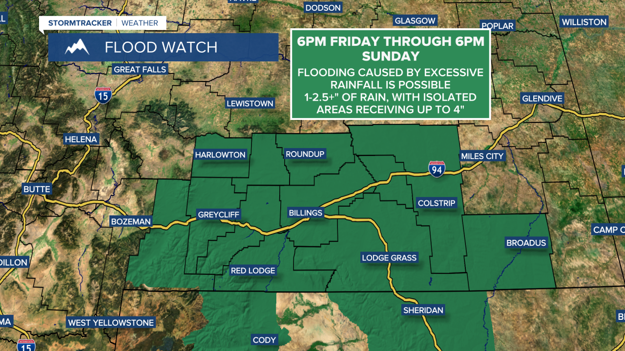
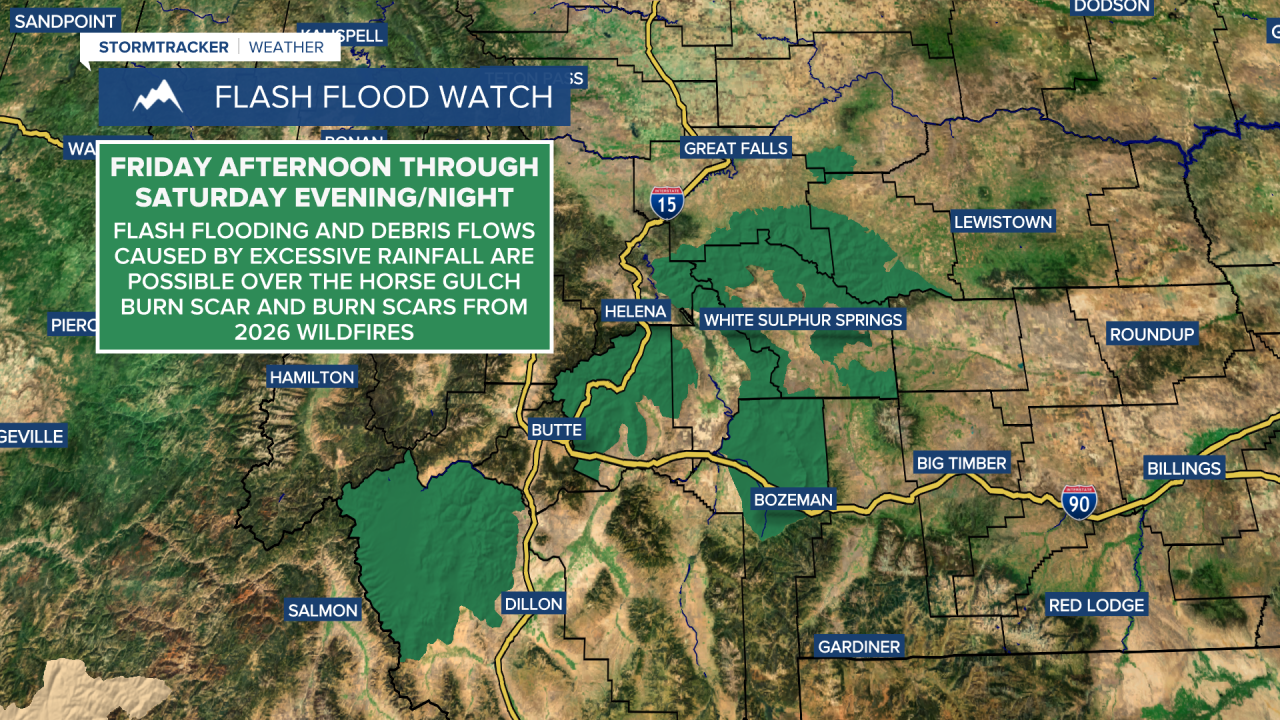
Around Helena, the highest rainfall amounts will be south and east of town, while the lowest rainfall amounts will be north of town. Most areas around Helena, including the capital itself, will receive .5-1.5” of rain over the next two days. In north-central Montana, many areas will receive little to no rain, but up to a third or a half an inch of rain will be possible in southern Cascade, southern Judith Basin, and southern Fergus Counties. In northeastern Montana, .1” to .5” of rain is expected in most areas.

Cooler temperatures are expected tomorrow around Helena and in Judith Basin County and Fergus County as highs are going to be in the mid to upper 50s and low to mid 60s. Elsewhere, highs tomorrow will be in the upper 60s and low to mid 70s. On Sunday, highs are going to be in the mid to upper 60s and low to mid 70s, with the coolest temperatures in northeastern Montana and in Fergus County. There will be little to no wind around this weekend.
Beautiful early fall weather is expected next week as an upper-level ridge will be in control of our weather. From Monday through Thursday, expect mostly sunny skies, mainly dry conditions, and warm temperatures (for this time of year), with highs in the 70s and low to mid 80s.


Have a fantastic Friday and weekend!
Chief Meteorologist Ryan Dennis
