

Good Morning and Happy Thursday! An upper-level ridge is going to be in control of our weather for at least the next week, which means you can expect lots of sunshine, widespread haze, mostly dry conditions, and hot temperatures.
The flow aloft will continue to be out of the west/southwest over the next week, which will continue to bring smoke from fires burning in Oregon, Washington, and occasionally British Columbia into the state. This means it will continue to be hazy for at least the next week, and at times, it may be smoky. The smoke will usually be aloft, just causing reduced visibility and filtered sunshine, but occasionally the smoke may be near the surface. The air quality will generally be in the “moderate” category, but at times it may be unhealthy for sensitive groups.
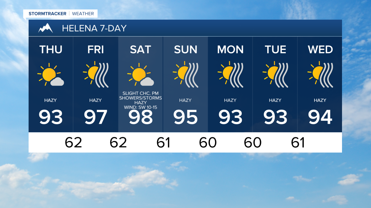
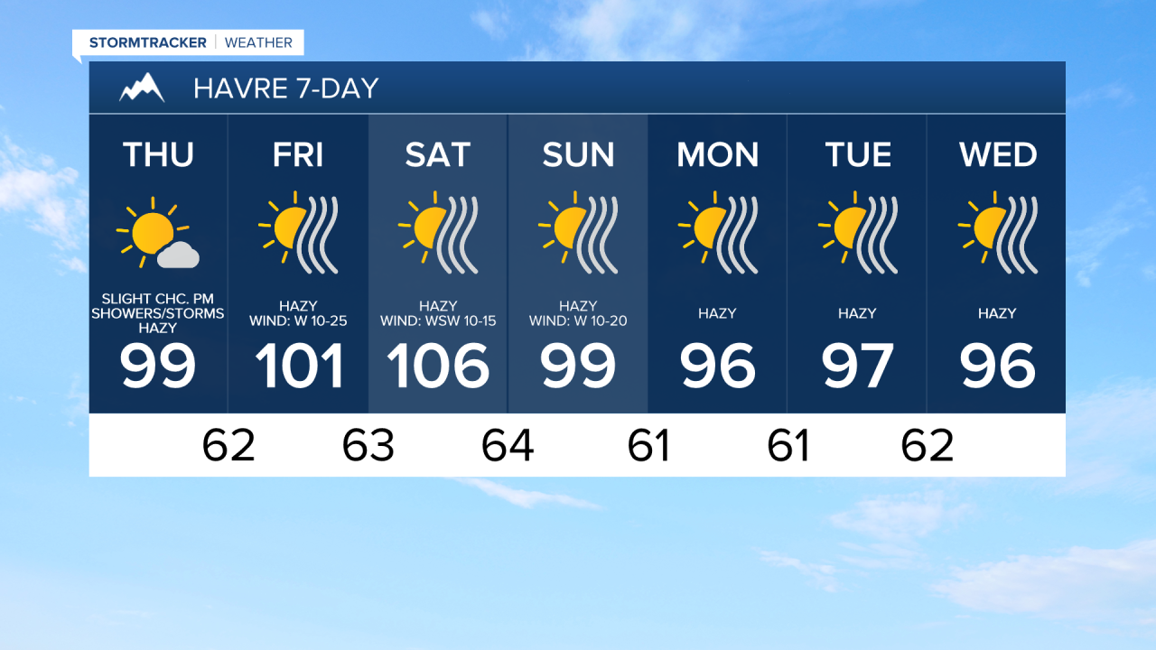
It is also going to be very hot over the next week as high temperatures are going to be in the 90s and 100s. As of right now, the hottest temperatures are expected tomorrow and this weekend as highs in most locations will be between 95° and 105°. If you are going to be outdoors at all, make sure you stay hydrated, wear sunscreen, wear light-colored and loose fitting clothing, and seek shade as much as possible. Also, make sure you consistently check on those that are more prone to heat illnesses, including the young, the old, and your pets. An EXTREME HEAT WATCH is in effect for most of central and eastern Montana from Friday morning through Sunday evening.

Today it will be breezy along the Rocky Mountain Front and the Continental Divide as sustained wind speeds are going to be between 10 and 20 mph. Elsewhere, there is only going to be a little breeze around as sustained wind speeds are going to be between 5 and 15 mph. Widespread breezy conditions are then expected tomorrow as sustained wind speeds are going to be between 10 and 25 mph, and gusts up to 40 mph are possible. This weekend, the wind won’t be as widespread, but it will continue to be breezy in a lot of areas with 10-25 mph sustained winds and gusts of 30-40 mph are possible. The strongest wind this weekend will be in western portions of north-central Montana.
This wind coupled with hot temperatures and low relative humidity will really elevate the fire danger, so please do your part to not start any new fires. A FIRE WEATHER WATCH is in effect for north-central Montana from 10am Friday until 9pm Saturday and for northeastern Montana from 10am until 9pm Friday.

Today it is going to be mostly sunny and there will be a few isolated showers and thunderstorms around during the afternoon and evening, generally along the Hi-Line and in the mountains. Tomorrow, it is going to be mainly sunny and mainly dry. On Saturday, it is going to be mostly sunny and there will be some isolated showers and thunderstorms around during the afternoon and evening. Most locations will remain dry though. Lots of sunshine and mainly dry conditions are then expected Sunday through at least next Wednesday. As a reminder, the sunshine over the next week will be a hazy sunshine due to wildfire smoke.

Have a tremendous Thursday!
Chief Meteorologist Ryan Dennis
