


A HIGH WIND WARNING has been issued for most of central, south-central and north-central Montana through Tuesday.
A WIND ADVISORY has been issued for most of western Montana through Tuesday.
A LAKE WIND ADVISORY has been issued for tonight into Tuesday morning.
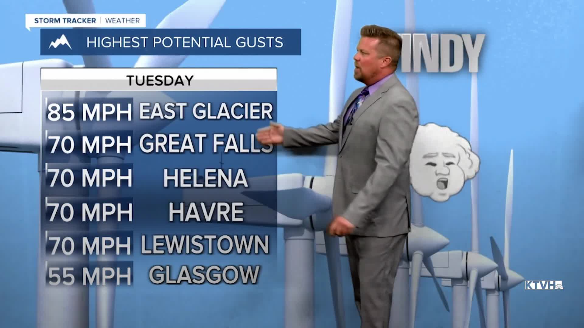
Strong wind will howl across Montana on Tuesday, with the potential of some minor damage and power outages. The wind will ramp up through the morning and peak in the afternoon. Much of Montana will see gusts in excess of 50mph, with many areas having the strongest wind gusts between 60mph and 70mph. That's strong enough to do some damage to trees, buildings and perhaps powerlines. This wind event will not be as strong as December's wild wind event. The wind will ease up through late evening. High temperatures will reach the 60s and 70s before a cold front passes. Tuesday night will be chilly with lows in the 20s to around 30. Some strong wind will howl in eastern Montana on Wednesday, but most of the state will have much lighter wind gusting up to 20mph. Skies will be partly cloudy and highs will be cooler in the 40s and 50s. Thursday morning a weak front will move across central Montana with just a period of light snow, possibly mixed with a little rain. Nothing more than a coating of accumulation is likely. The front will clear by afternoon with skies becoming partly cloudy. Highs again will be cooler in the 40s and 50s. Friday will be a gorgeous day with temperatures in the 50s and 60s under mostly sunny skies. This weekend will start out great on Saturday but a few scattered showers and thunderstorms will pop over southwest Montana in the afternoon. Most of the state will be dry. Highs will warm into the 60s. Sunday will be a cloudier day with widespread showers, isolated thunderstorms, and some high mountain snow. Highs will be cooler in the 40s and 50s. There is potential for lowering snow levels through Sunday night into Monday. Some snow could accumulate in the lower elevations as the storm moves away. Either way, there will be decent moisture from this storm.
Have a great day,
Curtis Grevenitz
Chief Meteorologist
