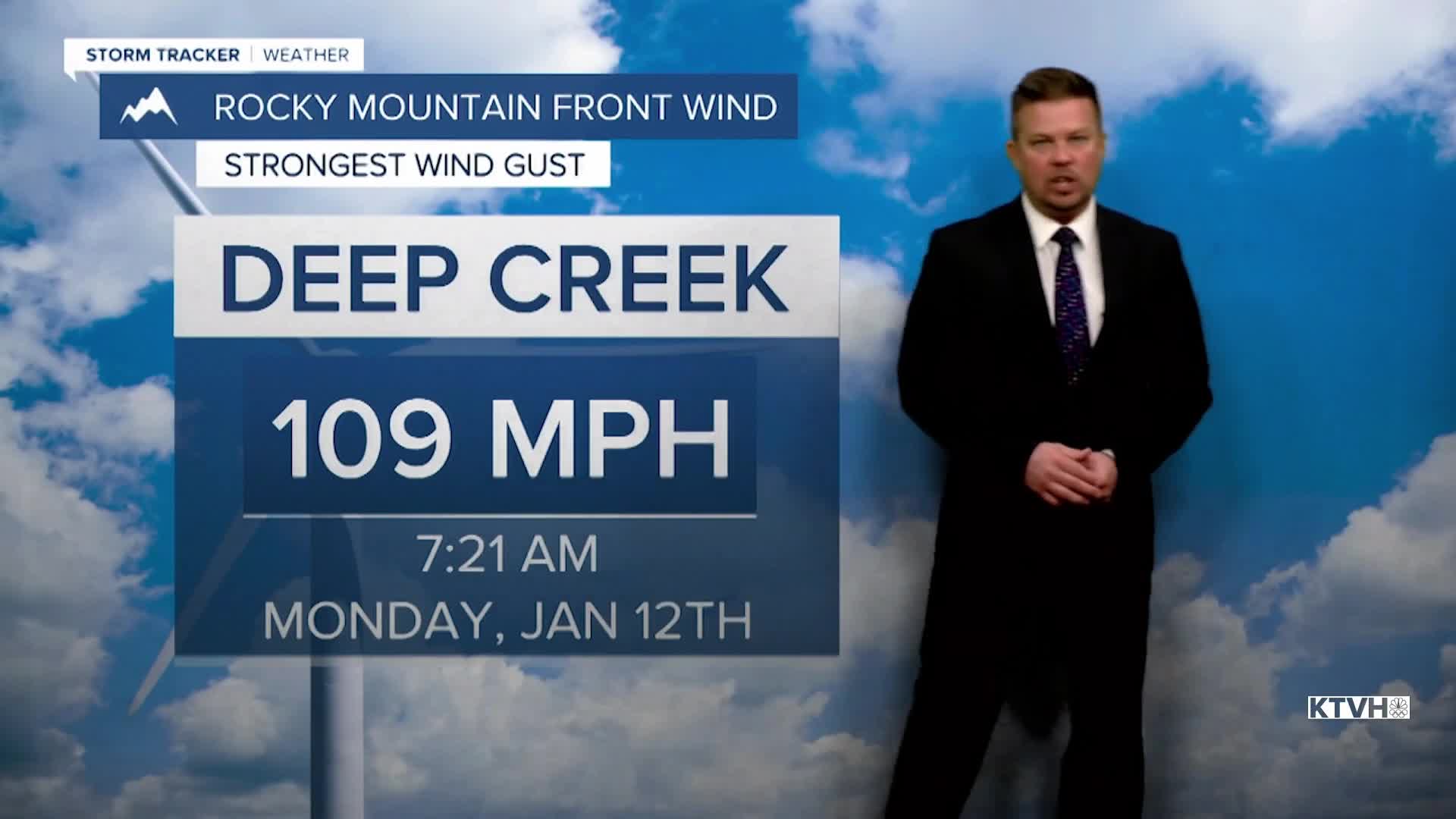


Holy cow! No, we're not at Shellie's Country Cafe. Powerful wind and near record breaking warmth in January continues. 109mph wind gust near East Glacier on Monday morning was stronger than any gust in the state in 2025, including that devastating wind storm in December. And on the warm side of the story, Helena tied a record high of 57 with several other towns getting within a few degrees of their records. This pattern will continue through the week, this MLK holiday weekend, and into next week. However, there are indications of more typical January weather returning by late next week. Tuesday will be another mild to warm day with highs in the 40s and 50s. A few showers of rain are possible in the morning, with snow confined to above about 7000'. Skies will be mostly cloudy through the morning with partial clearing through the afternoon. It will be windy again but not as windy, some gusts could top 40mph. Wednesday will start out mostly sunny with a strong wind across the plains. Highs will again be well above average, in the 50s and low 60s. Some valley locations will hold in the 40s. A few record highs could be broken. A weak cold front will move through the state on Thursday. Skies will be partly cloudy and it will turn windy and somewhat colder. Highs will range from the 30s in northeast Montana to the 50s farther south and west. A few isolated snow showers are possible in the central mountains and across the plains of eastern Montana. The combination of strong wind and colder temperatures will be felt more across the eastern part of the state. High pressure will move in for Friday with mostly sunny and slightly cooler highs in the 30s and 40s. It's likely that most of Montana will be dry, mild, with wind across the plains through Martin Luther King Jr. holiday weekend. It is possible that a return to more typical snowy and cold weather will occur later next week around January 21st.
Have a great day,
Curtis Grevenitz
Chief Meteorologist
