



A FLOOD WATCH has been issued for parts of northern and western Montana through the weekend.
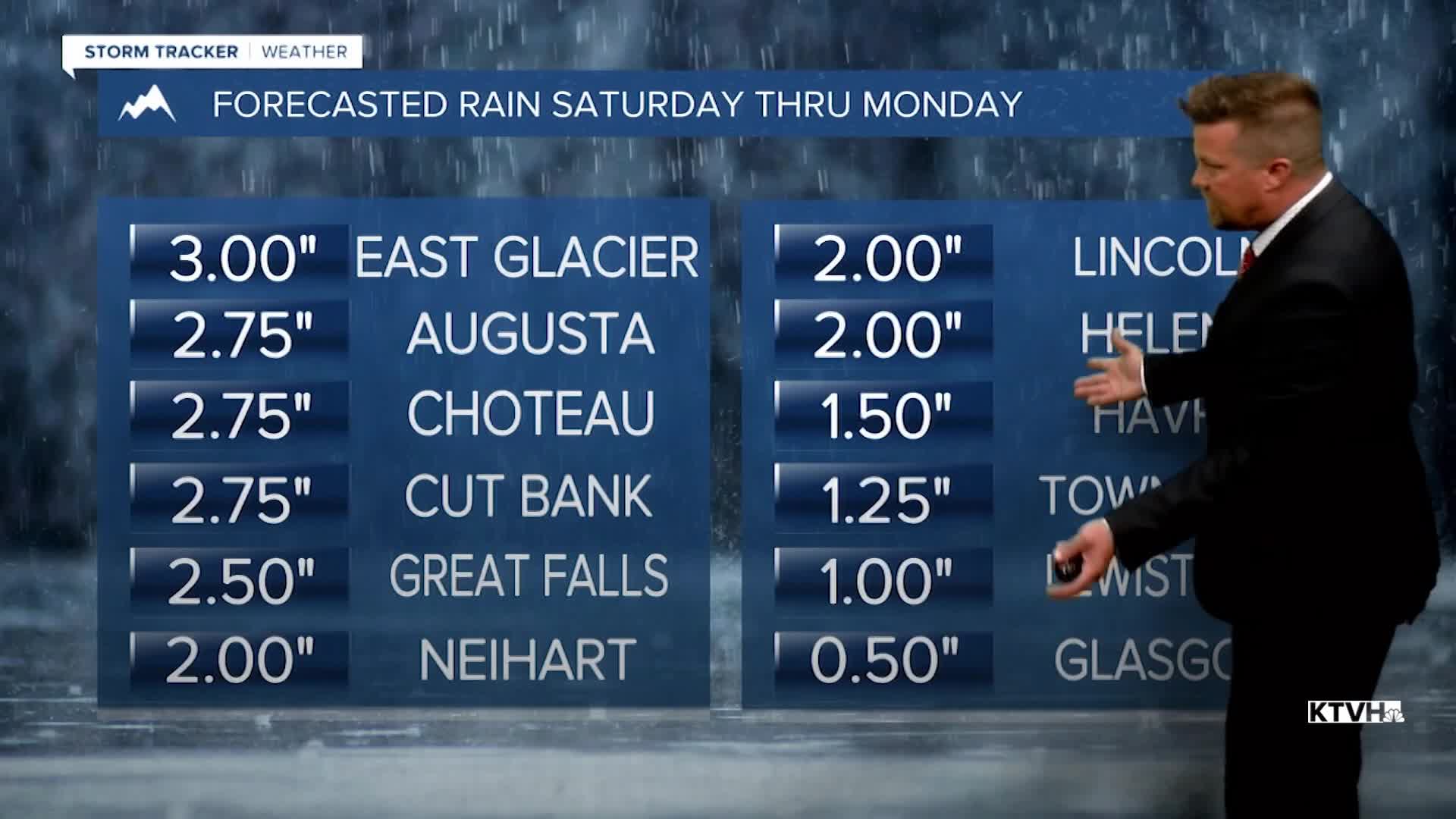
One of the wettest weekends in a while, possibly in the last few years, will drench Montana with too much rain that could lead to flooding. A storm like this only comes along every few years. Some statistics show that this could be a 1 in 5 to a 1 in 25 year storm. A big low pressure system will slowly move across Montana with widespread significant rain. There will be some strong to severe thunderstorms across eastern Montana. Heavy snow will fly in the higher mountains. Highs will be cooler in the 50s and 60s on Saturday. Steady to heavy rain will continue through Saturday night and Sunday. Rain will slowly wind down through Monday night but showers and a few thunderstorms are still possible through the middle of next week. With up to several inches of rain likely, flooding is looking more and more likely, especially the creeks along the Continental Divide, the Rocky Mountain Front, Glacier Area, and the Big and Little Belt Mountains. Flood potential will really increase through Sunday into Monday. If you are driving and encounter water over the road surface, remember to "turn around, don't drown" as the road could be washed away.
Have a good weekend,
Curtis Grevenitz
Chief Meteorologist
