A WINTER WEATHER ADVISORY is in effect for parts of the Hi-Line from Havre to Glasgow through Friday morning.
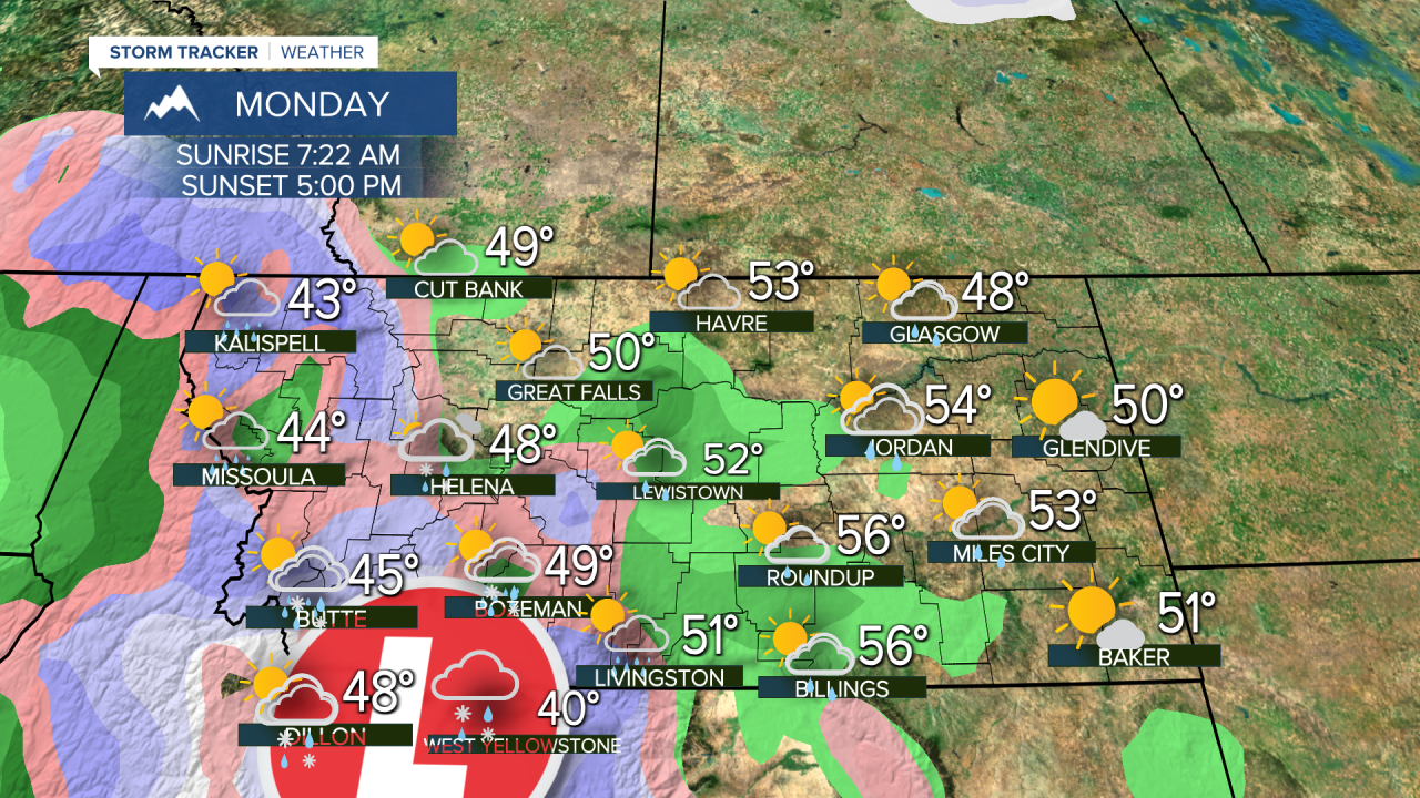
A pattern with storms coming in from the Pacific will leave Montana fairly mild with a series of showers and higher mountain snow moving through the state. These storms are coming from the Pacific as opposed to the arctic, so milder temperatures will produce mainly rain in the lower elevations with rising snow levels. However some cold air trapped up on the Hi-Line from around Havre through Glasgow to the North Dakota border will create conditions where a little freezing rain and light snow will fall. Roads will be slick through the night into Friday morning in that part of the state. Friday will be partly cloudy with a few lingering rain and snow showers. Once again a little snow and ice will fall up across northeast Montana in the morning, but most of the state will clear out through the afternoon. Highs will be in the 30s up across the northeast part of the state, 40s and 50s elsewhere. A stronger west wind should scour out any inversions as gusts reach 20-25mph. The first weekend of November will have another storm come in from the Pacific. Saturday will have increasing clouds through the morning and afternoon showers in the lower elevations, snow showers up high. Highs will be in the 40s to low 50s. Sunday will be a little unsettled with a few isolated rain and snow showers and partly cloudy skies. It will be breezy with highs in the 40s and 50s. The weather over the next week or so will be more typical of the season. There will be snow in the mountains and rain or snow in the lower elevations Monday into Tuesday, but the rest of the week looks fairly dry with high pressure moving in.
Curtis Grevenitz
Chief Meteorologist


