


A HIGH WIND WARNING has been issued for the Rocky Mountain Front and East Glacier area for Wednesday.
A WINTER STORM WARNING continues for the Beartooth and Absorka Mountains through Wednesday.
A FLOOD WATCH continues for northwestern Montana through Thursday.
An AVALANCHE WARNING continues for the backcountry of northwest Montana.
A WINTER WEATHER ADVISORY has been issued for Wednesday for the Rocky Mountain Front and northeast Montana.
A WINTER STORM WATCH has been issued for most of central and eastern Montana for Thursday through Friday.
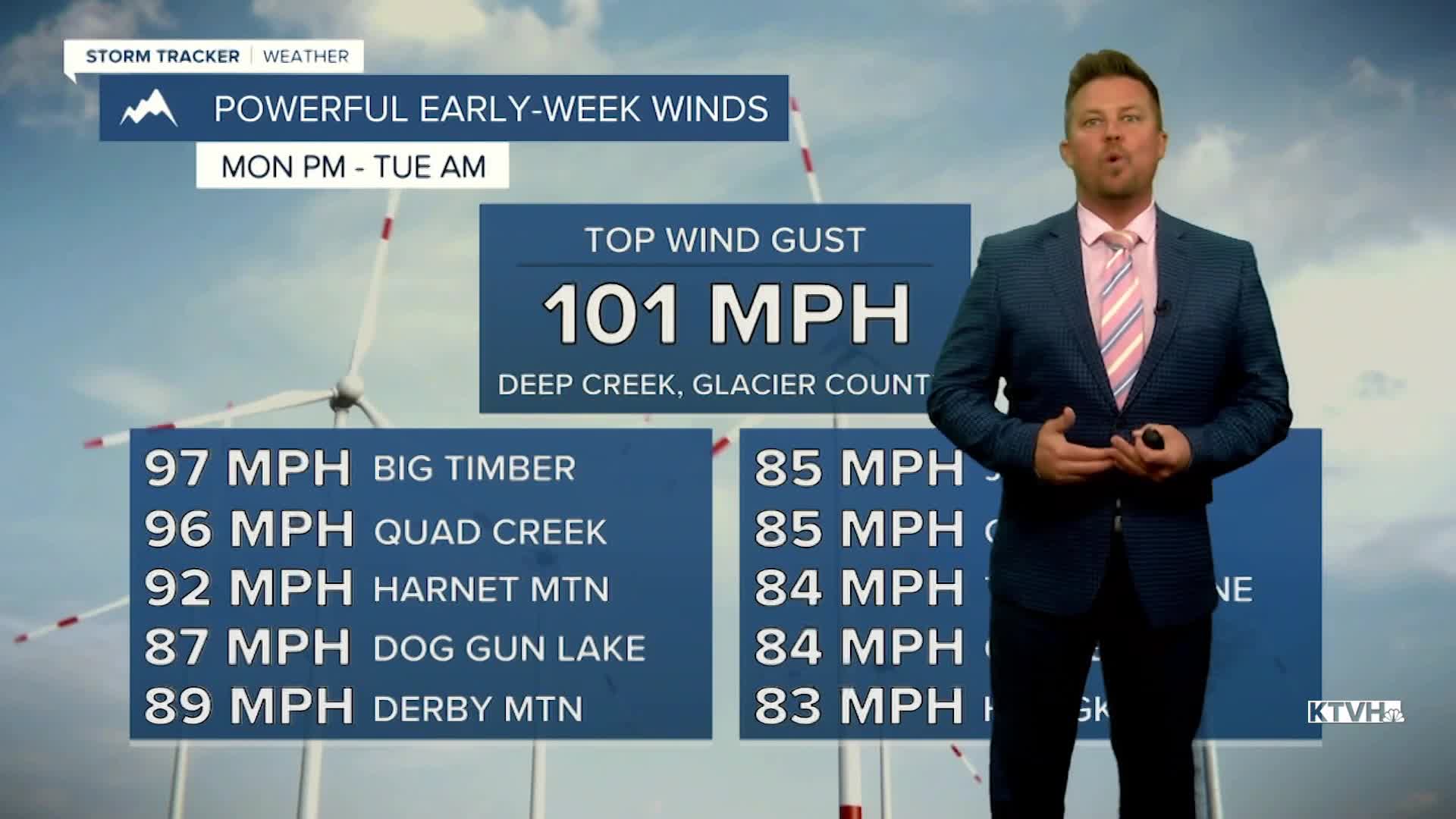
It's weather whiplash. That was one wild wind, that has eased up a bit. There will be more wind through the rest of this week, but there will also be more heavy rain, fluctuating temperatures, arctic air and heavy snow. An atmospheric river continues to deliver an incredible amount of moisture and mild Pacific air, but will run into some arctic air later this week leading to heavy snow for parts of Montana. Another wave of moisture will increase Tuesday night starting as snow, but snow levels will once again rise into Wednesday. Snow will change to rain through Wednesday morning with strong wind and highs topping out in the 40s and 50s. Northeast Montana should hang onto colder air throughout the day with snow and ice. On Thursday, rain will start changing back to snow as an arctic airmass moves into the state. Temperatures will start out mild in the 30s and 40s but fall throughout the day. Some areas will drop below zero Thursday night. A flash freeze is possible as the temperatures will drop quickly. Areas of snow will continue Thursday night and Friday. Several inches up to a foot will accumulate across central and northern Montana. Southern Montana will be warmer with less snow. Some snow will continue into Saturday morning. Northeast Montana will start out in the arctic air with temperatures below zero, but southwest Montana will stay warm in the 40s for highs. The arctic air will retreat through Sunday into early next week, with more Pacific air moving in. However, this extremely variable weather will likely return for the middle to end of next week. It's going to be a wild weather ride possibly into Christmas time.
Have a good day,
Curtis Grevenitz
Chief Meteorologist
