


A WINTER WEATHER ADVISORY has been issued for some of the higher elevations of western and central Montana into Thursday.
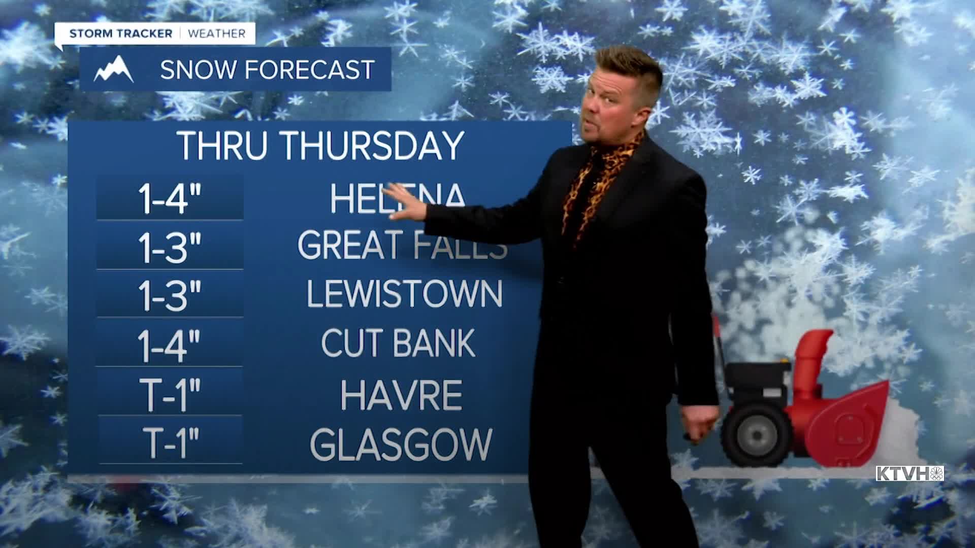
A nice, little storm will move through the state with some good precipitation. It will be a mix of rain and snow in the lower elevations, and healthy snow in the mountains. This is not a huge storm, but it will bring some much needed moisture to the state. Rain and higher elevation snow are currently moving through western Montana. Snow will increase in the mountains this evening. Rain could be moderate at times in the lower elevations. Snow levels will lower through the night to the valley floors and the plains by Thursday morning. Mountain passes will certainly be slick, with some slushy accumulation on the roads in the lower elevations. The mountains will see up to 7" and the lower elevations will vary between 1-4". Areas of snow will continue in the mountains on Thursday with snow showers, possibly mixed with rain in the lower elevations through the evening. Highs will be in the 30s and 40s. The heaviest precipitation will be across the southern mountains. That storm will move away on Friday with some lingering mountain snow showers. Highs will be in the 40s to near 50 for the lower elevations, 20s and 30s in the mountains. Saturday will be mild and windy with highs in the 50s and 60s. Skies will be partly to mostly cloudy. A few flakes and raindrops are possible in the mountains. The wind will really howl, and a high wind warning may be needed for the Rocky Mountain Front at least. Saturday night, don't forget to set your clocks forward as Daylight Saving Time goes into effect. We lose an hour of sleep but gain that wonderful hour of daylight on Sunday evening. A cold front will move into northern Montana late on Sunday with gusty wind and an increase in lower elevation rain and mountain snow. Highs will cool into the 40s and 50s. Colder air will move in for Monday with rain mixing with and changing to snow. Much of next week will be colder with chances for accumulating snow in the lower elevations. This is much-needed moisture.
Have a great day,
Curtis Grevenitz
Chief Meteorologist
