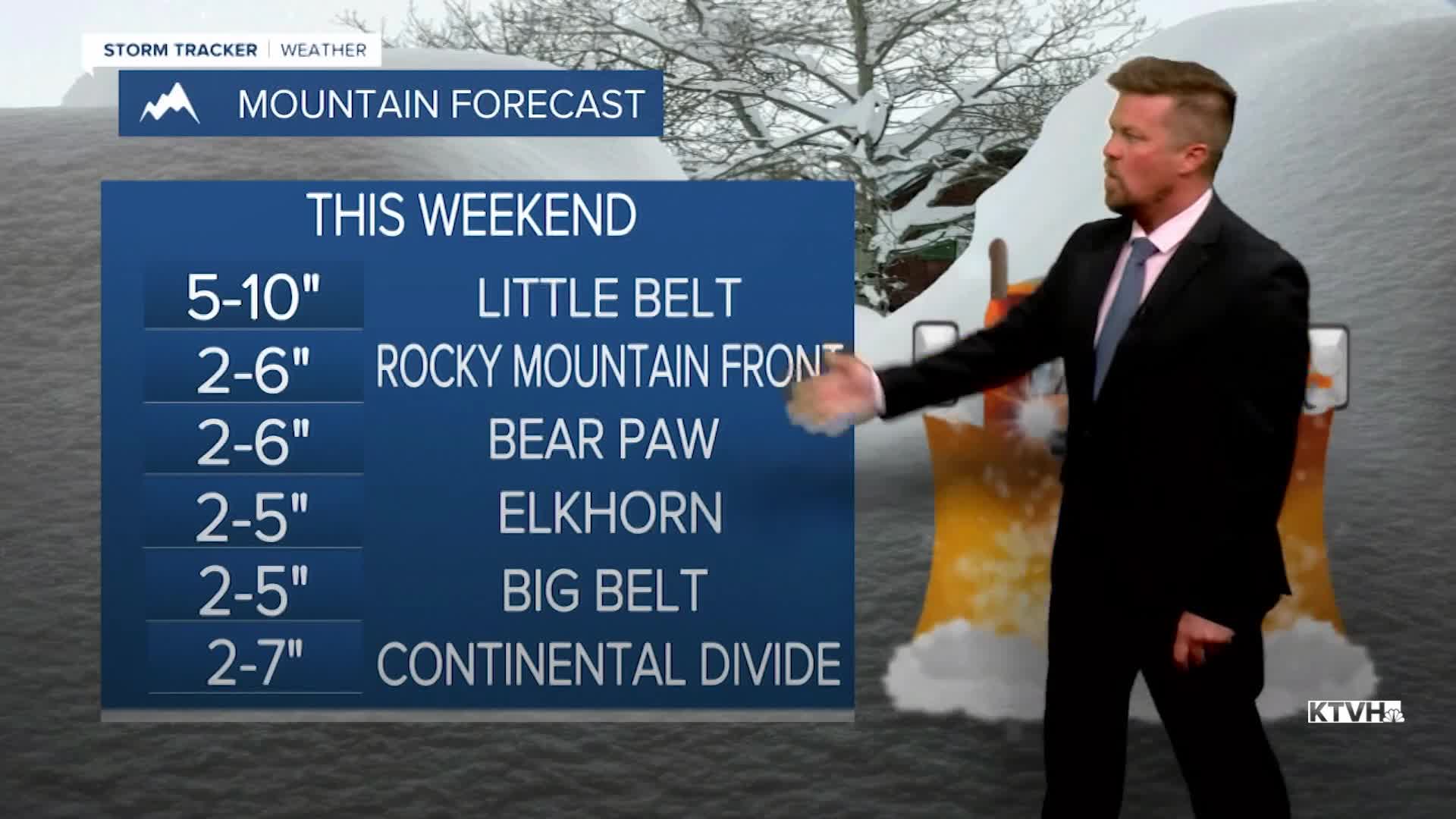


A WINTER WEATHER ADVISORY has been issued for the mountains this weekend.
After a wild week of record heat, severe thunderstorms, a tornado, destructive wind, blowing dust closing down roads, and new wildfire starts, now rain, snow and cold will hit Montana this weekend. Saturday will be cloudy with showers and thunderstorms in the lower elevations, and some snow in the mountains. Highs will be in the 40s and 50s. Low pressure will strengthen over the state with rain and snow increasing through Saturday night into Sunday. Sunday will be cool and cloudy with areas of rain and snow in the lower elevations, and snow in the mountains. The lower elevations should not see much if any snow accumulation, but several inches will fall in the mountains. Highs will only be in the 30s and 40s. Sunday night will be cold with lows dropping into the 20s in some areas. Active weather will continue next week with temperatures slowly warming, but showers and thunderstorms scattered about. Memorial Day Weekend right now looks stormy.
Have a great weekend,
Curtis Grevenitz
Chief Meteorologist
