


AN EXTREME COLD WARNING has been issued for Hill and Blaine Counties for Saturday into Sunday morning.
A COLD WEATHER ADVISORY has been issued for most of northern Montana through Saturday.
A WINTER WEATHER ADVISORY has been issued parts of central and western Montana through Saturday.
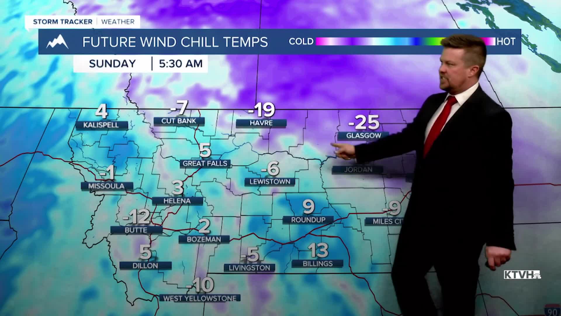
The final weekend of 2025 will have snow and a big drop in temperatures with dangerously cold wind chills. Christmas was mild but a sharp dose of reality is about to hit. Saturday will be mostly cloudy with areas of snow, highs in the 0s and 10s north, 20s and 30s south. Wind chill values could fall to between -20 and -40 for much of Montana as a strong cold front moves across the state. Most of Montana will drop into the -0s and 0s Saturday night into Sunday morning. High pressure will move in on Sunday with mostly sunny skies. Highs will range from near 0 in northeast Montana to the 10s and 20s elsewhere. The final few days of 2025 next week will be fairly quiet. Inversions will trap colder air in the valleys while the plains slowly warm up and get windy. Some colder air will sneak back into northern Montana by Wednesday, but it may not be until the first weekend of 2026 before a storm hit.
Merry Christmas,
Curtis Grevenitz
Chief Meteorologist
