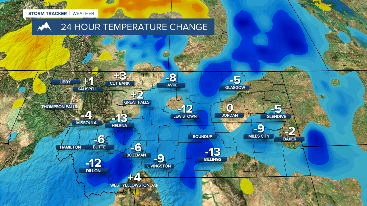
Temperatures are dropping significantly and cloud cover is growing as we kick off our Wednesday in Montana. Check out the 24 temp change as of 7AM - might want to grab those extra layers as you're heading out the door!
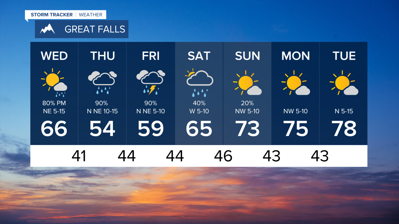
This change is due to a low-pressure system that's currently sweeping through the Pacific Northwest. Montana will start to see the impact of rainstorms this evening and that activity carries through Saturday morning. This rain will ramp up tonight as you're sitting down for dinner and getting ready for bed around 8 or 9PM.
Here's a look at how this system will progress Wednesday into Thursday.

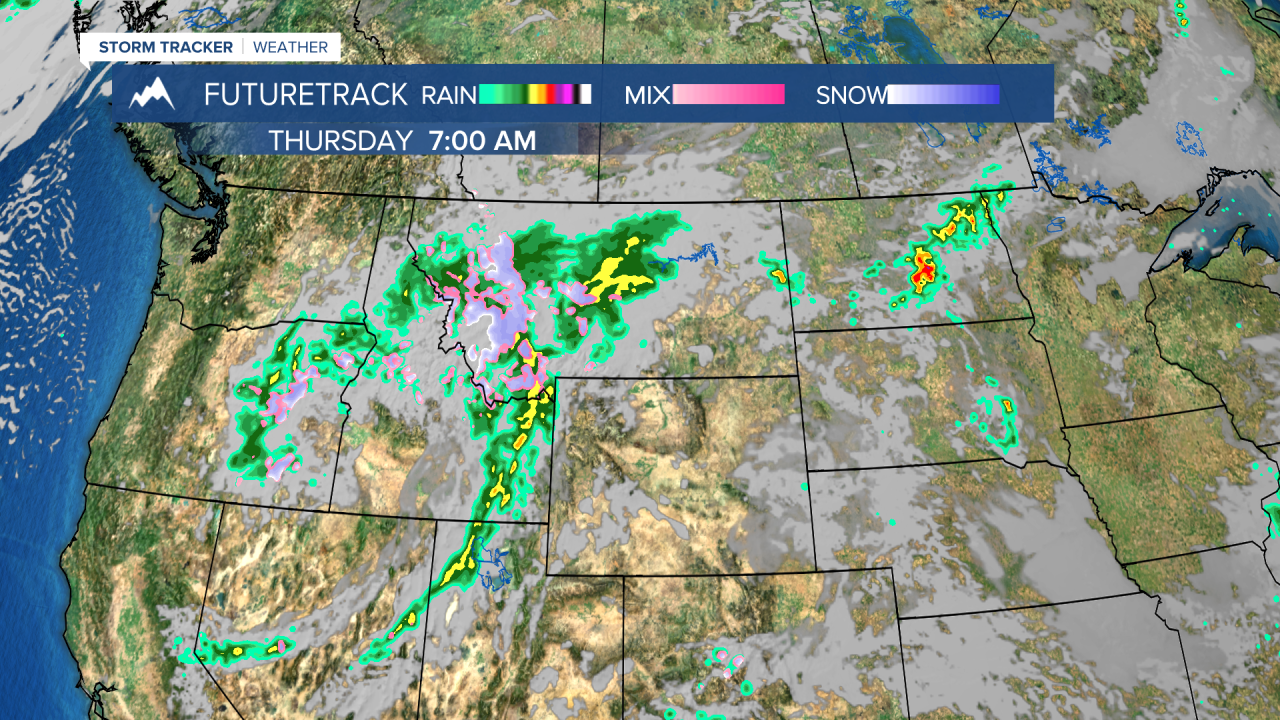
We're looking at the biggest concentration of moisture towards southern Montana towards Billings where we could see upwards of 1 inch of rain. Elsewhere will see less than 0.5 inches of accumulation. Some wet snow is expected in higher elevations. Highest likelihood is above 7,500 ft in areas of southwestern Montana and above 7,000 feet to the north with this low-pressure system.
Temperatures will continue to stay below normal as the brunt of this system hits Montana Thursday and Friday. Light at the end of the tunnel is warmer and sunnier weather expected Sunday as this cooler, wetter weather exits the region. I'm looking forward to that sweet, sunny relief already. Enjoy!