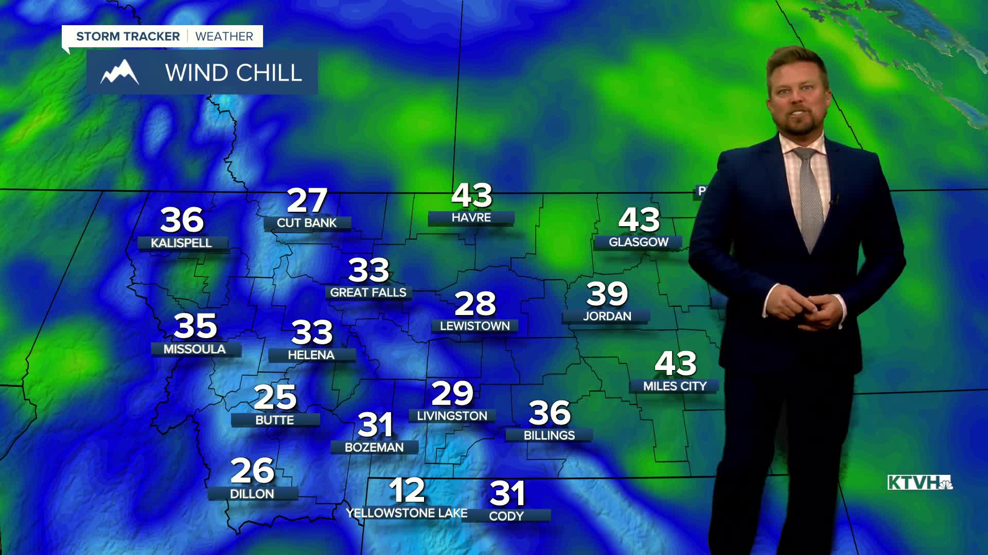


The coldest wind of the season blew across the state the last few days, but it will ease up with moderating temperatures this week. Wind chills in the 10s, 20s and 30s and wind gusts up over 40mph made it pretty uncomfortable to be outside. After a chilly Monday night, temperatures will moderate some this week and the wind will not be as bad. Tuesday will be a mostly sunny day with light wind for most of the state. It will still be seasonably cool with highs in the 40s to around 50. Some clouds will increase late in the day ahead of the next storm system moving in. This storm will mainly produce wind more than anything on Wednesday. The day will start out mostly cloudy with a few showers in the mountains, but the afternoon will turn partly cloudy and very windy. Gusts could once again top 40mph. Highs will reach the 40s and 50s. Thursday will be a partly cloudy day with lighter wind and highs in the 40s and 50s. Friday is Halloween and the kids do not have to have a snowsuit under their costume this year. The weather should be quite pleasant with highs in the 50s and light wind. Trick or Treaters will have temperatures falling into the 40s under partly cloudy skies on Friday evening. This weekend is the first of November and the first storm of the new month will move in. Saturday will be mostly cloudy and windy with a few showers mainly in the mountains. Highs will be mild in the 50s to around 60. Wind could be strong with gusts topping 30-40mph. Sunday will start out mostly cloudy with a few showers of rain and snow. Highs will be cooler in the 40s and 50s. Precipitation does not appear very heavy. This weekend, Daylight Saving Time comes to an end. We "fall back" on Saturday night. Sunday evening darkness will be an hour earlier, but there's an extra hour of sleep Saturday night.
Have a great day,
Curtis Grevenitz
Chief Meteorologist
