


A HIGH WIND WARNING continues until midnight for northern Montana.
A RED FLAG WARNING continues for northeast Montana until 9pm Friday.
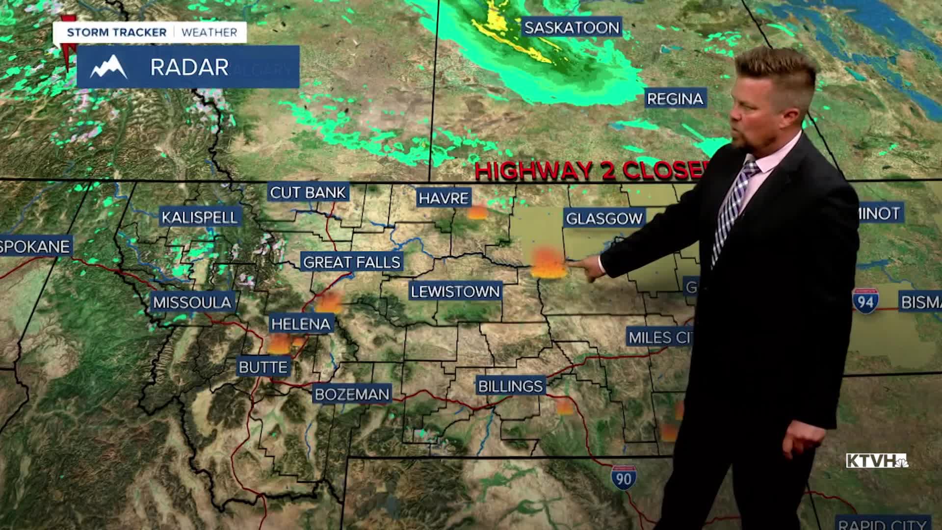
A BLOWING DUST ADVISORY continues for northeast Montana.
A powerful storm continues to bring severe weather conditions to much of Montana, with most of the impact currently coming from relentless wind. Powerful wind has knocked down trees and powerlines, but also stirred up dust on the Hi-Line. Highway 2 was closed between Glasgow and Wolf Point because of reduced visibility in the dust. Several small wildfires were started in the strong wind as well. The storm responsible for all of the hazards and trouble will slowly be moving out, thus the wind will slowly continue to ease up. However, the next few days will have their fair share of wind and active weather.
Friday will be partly cloudy with an isolated shower or thunderstorm in the lower elevations, and a few snow showers in the mountains. Highs will be in the 50s and 60s. This weekend will be a little more unsettled than last as a new storm moves in. Saturday will turn mostly cloudy with showers and thunderstorms in the lower elevations, and some snow in the mountains. Highs will be in the 40s and 50s. Low pressure will strengthen over the state with rain and snow increasing through Saturday night into Sunday. Sunday will be cool and cloudy with areas of rain and snow in the lower elevations, and snow in the mountains. The lower elevations should not see much if any snow accumulation, but several inches will fall in the mountains. Highs will only be in the 30s and 40s. Sunday night will be cold with lows dropping into the 20s in some areas. Active weather will continue next week with temperatures slowly warming, but showers and thunderstorms scattered about. Memorial Day Weekend right now looks stormy.
Have a great day,
Curtis Grevenitz
Chief Meteorologist
