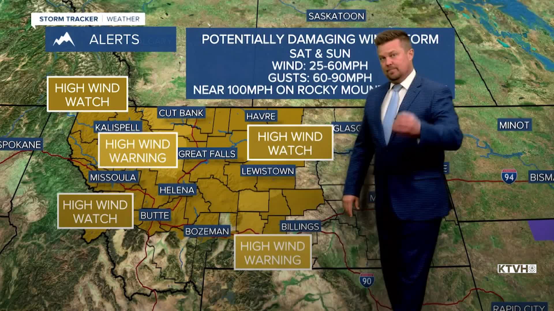


A HIGH WIND WARNING has been issued for much of Montana for this weekend.
Saturday and Sunday will be very windy as powerful gusts stretch across the state of Montana. The recent standard for powerful wind storms is the destructive December event that hit the entire state. This weekend's storm will not be as strong but it will affect most of Montana. Most areas will see sustained wind between 20-40mph with gusts 50-70mph. The windier locations like the Rocky Mountain Front and East Glacier area will have sustained wind up to 50-60mph and gusts 90-100mph. This is the type of wind that could flip trailers over. Please use caution traveling. This is also the type of wind that could blow dust around and even whip up a wildfire. Saturday will be mild and windy with highs in the 50s and 60s. Skies will be partly to mostly cloudy. A few flakes and raindrops are possible in the mountains. On Saturday night, don't forget to set your clocks forward as Daylight Saving Time begins. We lose an hour of sleep but gain that wonderful hour of daylight on Sunday evening. A cold front will move into northern Montana late on Sunday with gusty wind and an increase in lower elevation rain and mountain snow. Highs will cool into the 40s and 50s. Sunday's wind will be the strongest as the cold front approaches. Colder air will move in Sunday night into Monday with rain mixing with and changing to snow. Much of next week will be colder with chances for accumulating snow in the lower elevations. There will also be pretty strong wind each day.
Have a great weekend,
Curtis Grevenitz
Chief Meteorologist
