


An EXTREME COLD WARNING has been issued for parts of northeast Montana for dangerous cold wind chills through Sunday morning.
A COLD WEATHER ADVISORY has been issued for parts of northern and eastern Montana for dangerously cold wind chills.
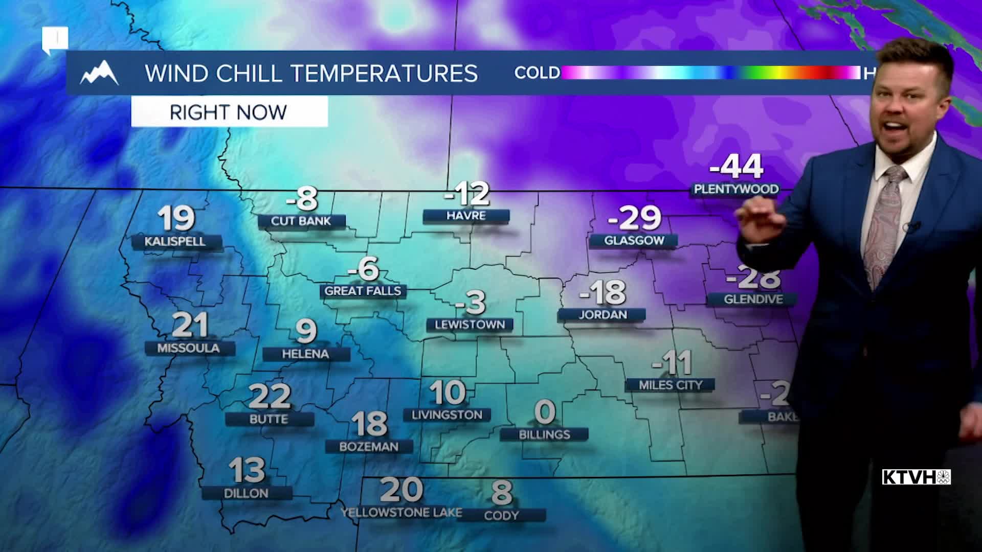
Wind chill values have dropped to -50 in northeast Montana as the coldest airmass of winter moves across Big Sky Country. Thursday night will be the coldest with temperatures dropping to near -30 across northeast Montana, and much of Montana east of the Continental Divide will have lows at or colder than zero. Wind chill values could approach -40 to -50 for parts of the Hi-Line through northeast Montana not just through Friday, but all the way into Sunday. Elsewhere in the state, wind chills will be between 0 and -20. Areas of light snow will continue with up to an inch of accumulation through Thursday night. Friday will be turn partly cloudy with highs in the 0s and 10s, some -0s and -10s across northeast Montana. Another cold front will move through the state on Saturday with mostly cloudy skies, areas of snow, and a reinforcing shot of cold air. Highs will be in the 10s and 20s but lows will drop to near and below 0 into Sunday morning. Again northeast Montana will be as cold as -30. Sunday should be mostly sunny with high pressure moving across the state. Highs will range from near 0 over northeast Montana to near 30 closer to the Continental Divide. Bundle up with the warmest clothing and travel safe in these conditions. Speaking of travelers, a major winter storm hitting the south and east coast this weekend will have a big impact on air travel into early next week.
Have a great day,
Curtis Grevenitz
Chief Meteorologist
