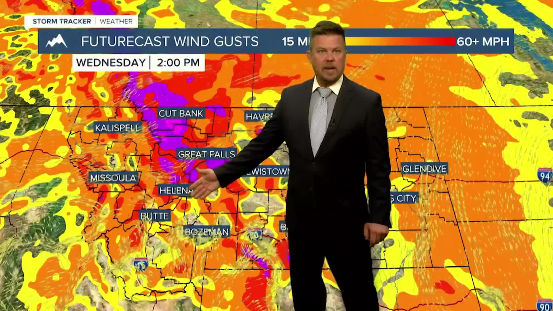


A HIGH WIND WARNING has been issued for the Cut Bank area for Wednesday.
Another round of strong wind will howl across the state on Wednesday as a cold front moves through Montana. This storm will mainly produce wind more than anything else. The day will start out mostly cloudy with a few showers in the mountains, but the afternoon will turn mostly sunny and very windy. Gusts could once again top 40mph. Around Cut Bank, gusts could reach as high as 65mph. High temperatures will top out in the 40s and 50s. Thursday will be a mostly sunny day with lighter wind for western and central Montana, eastern areas will still have a strong wind. Highs will be in the 40s and 50s. Friday is Halloween and the kids do not have to have a snowsuit under their costume this year. The weather should be quite pleasant with highs in the 50s and light wind. Trick or Treaters will have temperatures falling into the 40s under partly cloudy skies on Friday evening. This weekend is the first of November and the first storm of the new month will move in. Saturday will be mostly cloudy and windy with a few showers mainly in the mountains. Highs will be mild in the 50s to around 60. Wind could be strong with gusts topping 30-40mph. Sunday will start out mostly cloudy with a few showers of rain and snow. Highs will be cooler in the 40s and 50s. Precipitation does not appear very heavy. This weekend, Daylight Saving Time comes to an end. We "fall back" on Saturday night. Sunday evening darkness will be an hour earlier, but there's an extra hour of sleep Saturday night.
Have a great day,
Curtis Grevenitz
Chief Meteorologist
