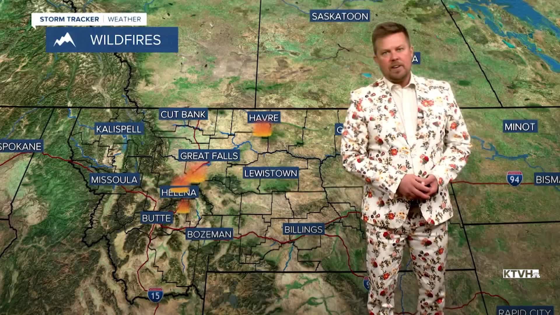


Several wildfires have broken out over the last few days because of wind, warm temperatures and dried grass that has not greened up yet. Even after all of the moisture from last weekend, wildfires are quickly spreading because of the wind. Wind will be an issue through the weekend, but it should not be as strong as Friday. All of these fires are human caused so please use caution. The next cold front will come through Montana on Saturday with showers in the lower elevations and a return of some light snow to the mountains. Temperatures will cool into the 40s and 50s through the afternoon. Most precipitation will be light. The wind will be gusty, but the humidity will be higher. Sunday will be mostly sunny with lighter wind and highs in the 40s and 50s. The next significant storm will come on Wednesday with a lot of wind, colder temperatures, a burst of rain and snow, and a return of snow to the mountains.
A solar storm is currently hitting Earth so the aurora borealis may be out for some at night.
Have a great weekend,
Curtis Grevenitz
Chief Meteorologist
