A HIGH WIND WARNING has been issued for the Northern Rocky Mountain Front and East Glacier until Tonight.
A WINTER STORM WATCH has been issued for the Rocky Mountain Front, Central and Southern Lewis and Clark Counties, Helena Valley is omitted.
A LAKE WIND ADVISORY has been issued for Fort Peck Late Until Wednesday at 4 am.
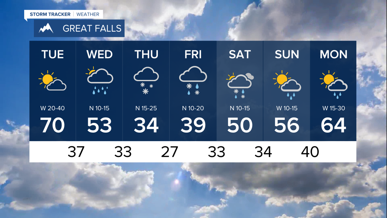
After a warm start to the week, changes will begin to move in. A front will bring strong wind, partly cloudy skies, and a few stray showers during the afternoon/evening to portions of south-central Montana, and a passing late-night shower to portions of northeast Montana. Daytime highs will be cooler than Monday's high temperatures. The high temperatures will top out in the 60s and 70s, as for eastern Montana, daytime highs will climb to the mid to upper 80s. If you are planning on taking the boat out, prepare for choppy conditions on the water. The National Weather Service has put in place a Lake Wind Advisory for Fort Peck and Flathead Lakes.
Wednesday, an upper-level storm system will move in and bring mostly cloudy skies, widespread showers, and cooler temperatures into the area. Showers will begin late morning or early afternoon in portions of west-central and southwest Montana. The high temperatures will begin to cool to the 50s and 60s. Overnight temperatures will drop near to below freezing, and that will allow rain to transition into snow in some valley locations and portions of north-central Montana.
Thursday, a cooler air mass will settle in and daytime highs will fall into the 30s and 40s. A few locations in north-central Montana will likely wake up to snow. The heaviest snow accumulations will be along the Continental Divide and Rocky Mountain Front. Up to 14" of snow could fall along the Rocky Mountain Front, and between three to six inches could fall in some locations in north-central Montana by Saturday morning. Travel will become difficult across mountain passes such as; MacDonald, Marias, Rogers, Kings Hill, and Homestake passes. Snow will continue Thursday night into Friday morning.
The precipitation that will fall over the next few days will be extremely beneficial to ongoing drought conditions.
Happy Tuesday.
A.R. 😊


