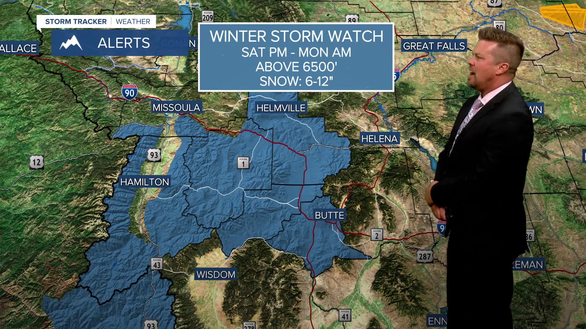


A WINTER STORM WATCH has been issued for the higher elevations of southwest and western Montana from Saturday afternoon into Monday morning.
A WINTER STORM WATCH has been issued for the mountains of southwest Montana for this big weekend storm that will produce the snow, heavy rain, severe thunderstorms, wind and cool temperatures. This is an unusual storm for late June for northern Rockies and Pacific Northwest, a beneficial storm with timely moisture ahead of the July 4th holiday weekend. Friday, a strong cold front will move into western Montana with increasing clouds and scattered showers and thunderstorms. Eastern Montana should be dry until much later in the evening, but those thunderstorms arriving late could be strong to severe with large hail and damaging wind. This weekend will be wet, cool, windy with some high mountain snow. Rain and a few thunderstorms will spread across the state on Saturday. Some severe storms are possible across far eastern Montana on Saturday afternoon and evening. Highs will cool down into the 60s. Sunday will be cloudy, rainy and windy with some high mountain snow. Steady, soaking rain will fall in some areas. Highs will top out in the 50s and 60s. The mountains above 6500' will be cold enough for that summer snow. Areas of heavy rain could continue into Monday, and there is the possibility of flooding in some areas around Glacier. The storm will slowly move out on Monday evening into Tuesday. Rainfall totals should generally be between 0.50" and 2.00" of rain, with up to a foot of snow in the mountains.
Have a great day!
Curtis Grevenitz
Chief Meteorologist
