

HELENA — The Helena Valley sits atop a variety of different sediments and rocks, making it particularly susceptible to earthquake damage should another major seismic event occur, like the magnitude 6.2 earthquake that struck the area in 1935.
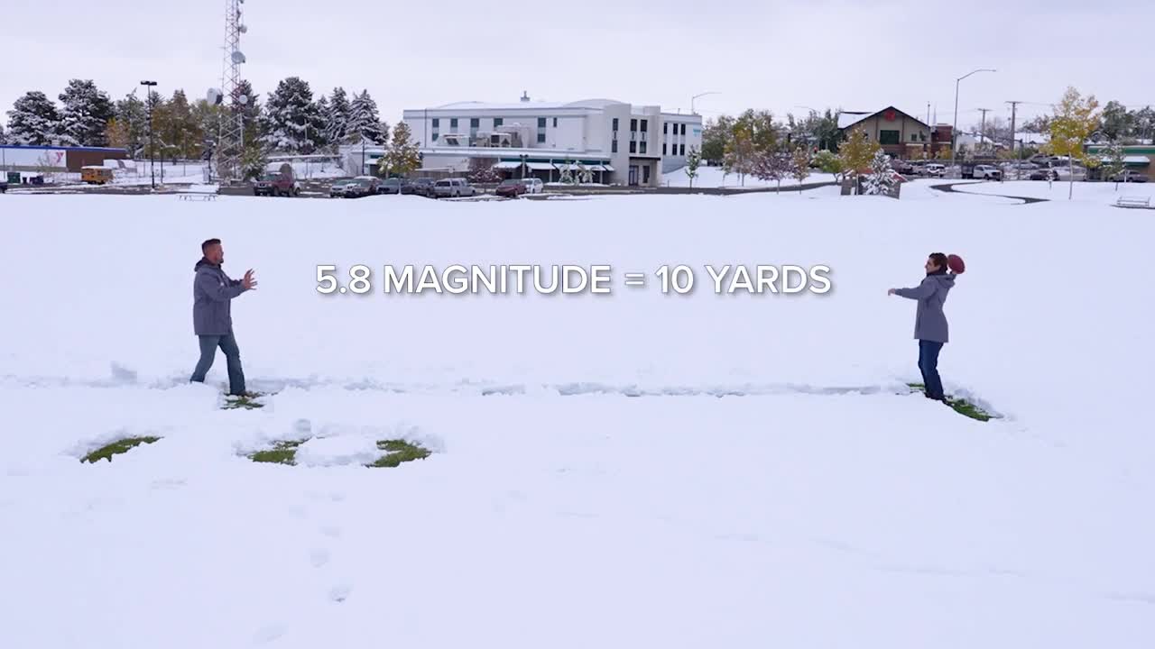
(WATCH: Curtis Grevenitz and Joey Biancone use football to explain the energy released in an earthquake)
Dr. Patricia Heiser, Associate Professor of Earth Science and Environmental Science at Carroll College, explains that Montana's complex geology makes the western part of the state especially prone to seismic activity. The region sits within what's known as the Intermountain Seismic Belt, a zone of faults that extends from the Canadian border through Yellowstone and down as far south as Arizona and New Mexico.
"Montana's very complicated," Heiser said. "The eastern part of the state is flat sedimentary rocks, but the western part of the state is folded up mountain belts."
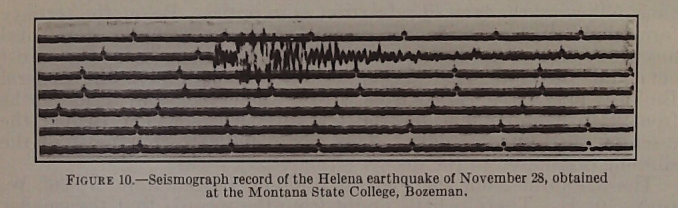
In early October, the 1935 earthquake sequence began with foreshocks, including a magnitude 5.9 tremor on the 12. The main shock, registering a 6.2 magnitude, hit on October 18th, followed by another deadly 6.0 magnitude aftershock on October 31st that caused additional building collapses and fatalities.
CLICK HERE TO LEARN MORE ABOUT THE 1935 HELENA EARTHQUAKE
The fault system responsible for the 1935 earthquakes remains active today, according to surveys that have mapped and categorized faults in the Helena Valley based on their recent activity. Some faults show evidence of movement within the last 130,000 years, and any of them could potentially rupture again.
WATCH: EXTENDED INTERVIEW THE DR. PATRICIA HEISER TALKING ABOUT THE 1935 EARTHQUAKES AND SEISMIC ACTIVITY IN THE HELENA AREA
"Any of them could be activated," Heiser said. "It depends on where the stresses build up. And if it gets locked in someplace, it could release in another place."
The Helena Valley's geological makeup amplifies earthquakes in more than just the shaking itself. The lower Helena valley is filled with loose sediments that can cause liquefaction, a process in which soil and clay can act like a liquid under intense, long-duration quake. This poses a major risk to structures and could lead to collapse.

Liquefaction hazard maps show the highest risk areas include zones along Ten Mile Creek, Prickly Pear Creek, and the area around Lake Helena. These locations could experience ground failure during a major earthquake due to their clay-rich soils.
The type of faulting in the Helena area creates primarily horizontal ground movement, similar to California's San Andreas Fault. This sliding motion can cause faults to "unzip" along their length, creating sequences of foreshocks, main shocks, and aftershocks as pressure releases in one area and builds up in adjacent sections.

The 1935 earthquakes serve as a reminder that major seismic events can and will occur again in the Helena Valley.
Editor's note: This article has been updated with a corrected spelling of Dr. Heiser's name.
