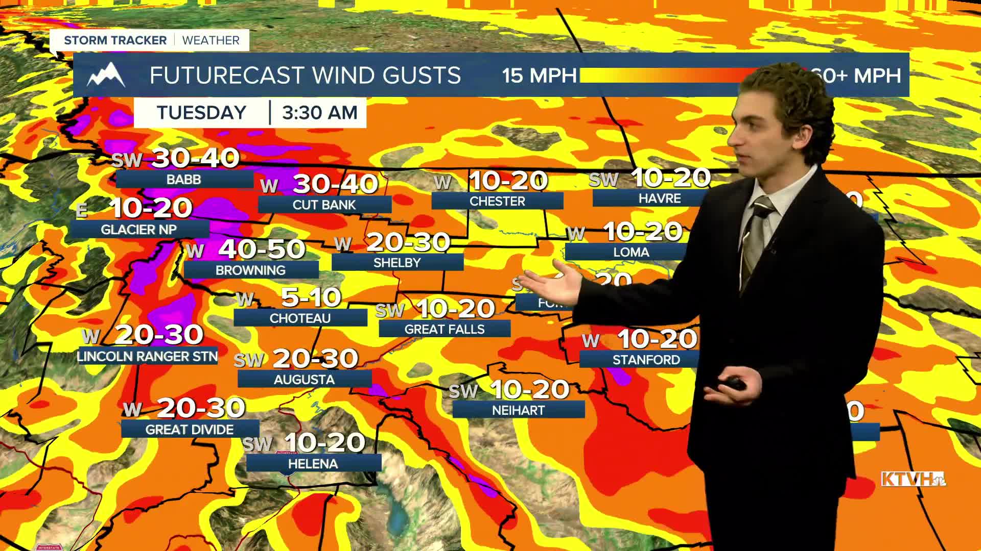


Wind gusts along the immediate slopes of the Rocky Mountain Front are already exceeding 80 MPH, as another day of strong wind is expected throughout Montana.
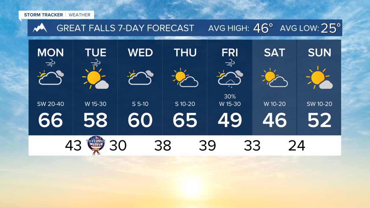
The gusty wind today will push highs into the upper 50s to mid-60s across much of the state. Expect partly to mostly cloudy skies due to Chinook Arches that have formed this morning.
A cold front will move through the area tonight, bringing sustained winds overnight and isolated showers to the mountains of western Montana.
Temperatures will stay on the milder side through most of the week, with highs in the 50s and low 60s and lows in the 30s.
Another cold front will make its way into our area Friday morning, bringing a little more shower activity back to the forecast. High temperatures drop into the 40s heading into the weekend.
——————————————————————————————————————————
WEATHER ALERTS:
A HIGH WIND WARNING continues for the Rocky Mountain Front and adjacent foothills and plains until 9 PM Monday
A HIGH WIND WARNING continues for Eastern Glacier, Western Toole, and Central Pondera Counties until 9 PM Monday
A WIND ADVISORY continues for the Beartooth Foothills and Livingston Area until 9 AM Tuesday
——————————————————————————————————————————
Helena Temperature Records Today:
High: 67 (1956)
Low: -24 (1986)
AVG: 45/25
Great Falls Temperature Records Today:
High: 67 (1971)
Low: -13 (2022)
AVG: 46/25