


FRIDAY, JUNE 5TH: It will be a beautiful day with highs in the upper 70s to low 80s under mostly sunny skies.
Expect the afternoon to be breezy once again, with winds 10-20 MPH out of the west. Gusts may approach 30 MPH at times.
SATURDAY, JUNE 6TH: A cold front will begin to move through the state, bringing afternoon showers and thunderstorms to the area. High temperatures will range from the 60s in western Montana to the 90s in eastern Montana. The Helena area will reach a high in the 70s. Expect partly cloudy skies with winds around 10-20 MPH.
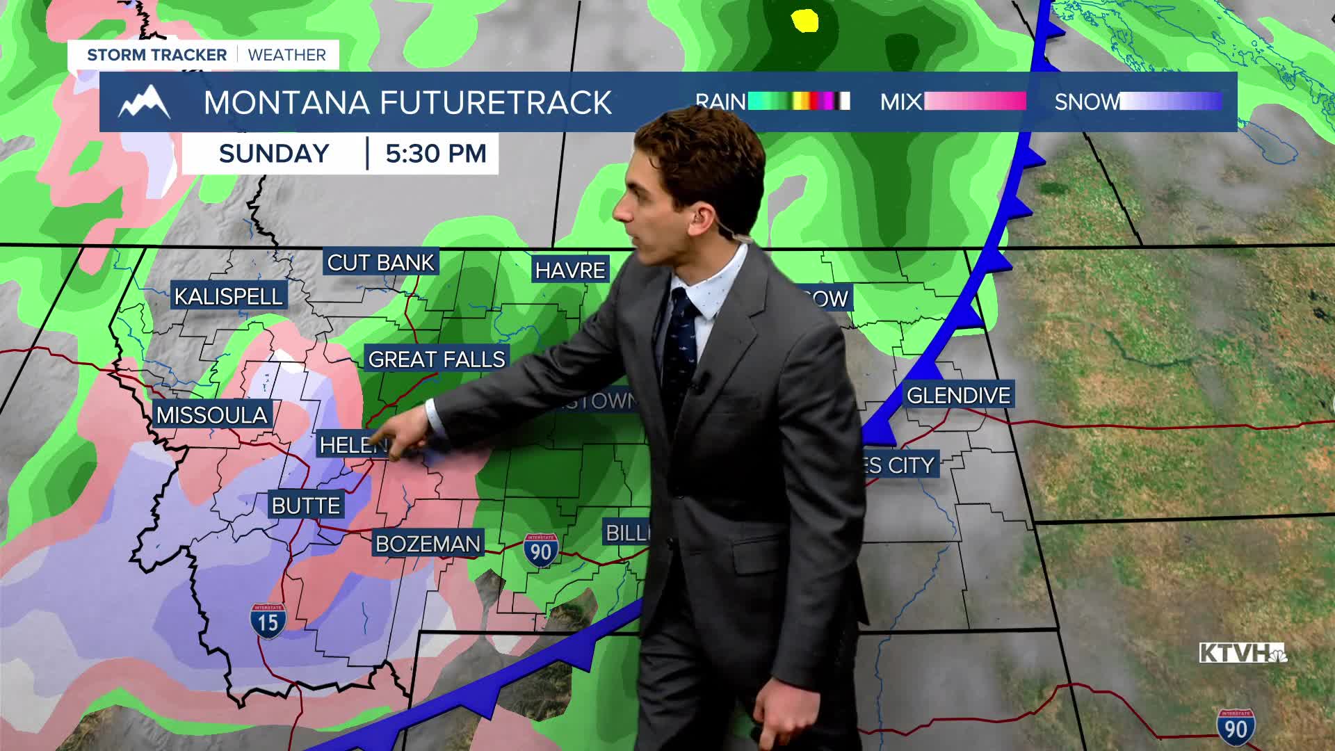
SUNDAY, JUNE 7TH: Rain showers will continue to impact the area, especially in the morning. We may even see a bit of mountain snow with cold air aloft, dropping to around 6000 to 7000 feet in the morning. Rain totals will not be as impactful as the past weekend's storm. Highs will only reach the 50s and 60s. Winds may gust near 20 to 30 MPH at times.
MONDAY, JUNE 8TH: Rain and snow move out of the area by the early morning, leaving partly cloudy skies for the rest of the day. Highs will warm into the upper 60s to low 70s.
LONG-RANGE FORECAST: We stay in an overall active pattern into next week. Scattered thunderstorms will return on Tuesday, but no widespread precipitation is expected until at least Wednesday of next week.
——————————————————————————————————————————
WEATHER ALERTS:
NONE
——————————————————————————————————————————
Helena Temperature Records Today:
High: 90 (2004)
Low: 33 (1960)
AVG: 71/47
Great Falls Temperature Records Today:
High: 92 (1969)
Low: 34 (1951)
AVG: 70/44


