


MONDAY, APRIL 20TH: It's a little chilly this morning with lows in the 30s and low 40s, but temperatures will quickly warm back into the 70s later this afternoon under mostly sunny skies. Winds will be light out of the west for most.
TUESDAY, APRIL 21ST: This will be the warmest day of the week, and one of the warmest days of the year so far. High temperatures will reach the upper 70s to low 80s. Some daily record highs will be in jeopardy.
Expect mostly sunny to partly cloudy skies, with isolated rain showers moving in after dark.
Fire danger will be heightened in southwestern Montana during the day with gusty winds near 30-40 MPH, temperatures in the 70s and 80s, and low relative humidity. These conditions will allow any fire that starts to spread rapidly.
EARTH DAY: Rain showers and thunderstorms will develop in western Montana from the late morning to early afternoon. A few thunderstorms could produce heavy rain and gusty winds. Once the initial round of showers and thunderstorms passes, expect the conversion to a more widespread rain/snow mix, and then eventually to all snow by late Wednesday night.
High temperatures will range from the 50s in the western portions of the state to the 80s in the eastern plains. Expect partly cloudy skies in the morning, then mostly cloudy for the rest of the day.
THURSDAY, APRIL 23RD: Widespread light snow is expected to fall through at least Thursday with the current track of the storm system, but this could vary slightly as we get closer to Thursday. Accumulation will be light in most lower elevations outside of the eastern plains, where nearly half a foot of snow may fall. The most impactful snow will be over the mountains of central Montana.
High temperatures will only reach the 30s and 40s, a significant cool-down compared to earlier in the week.
Scattered snow showers should stick around Thursday afternoon.
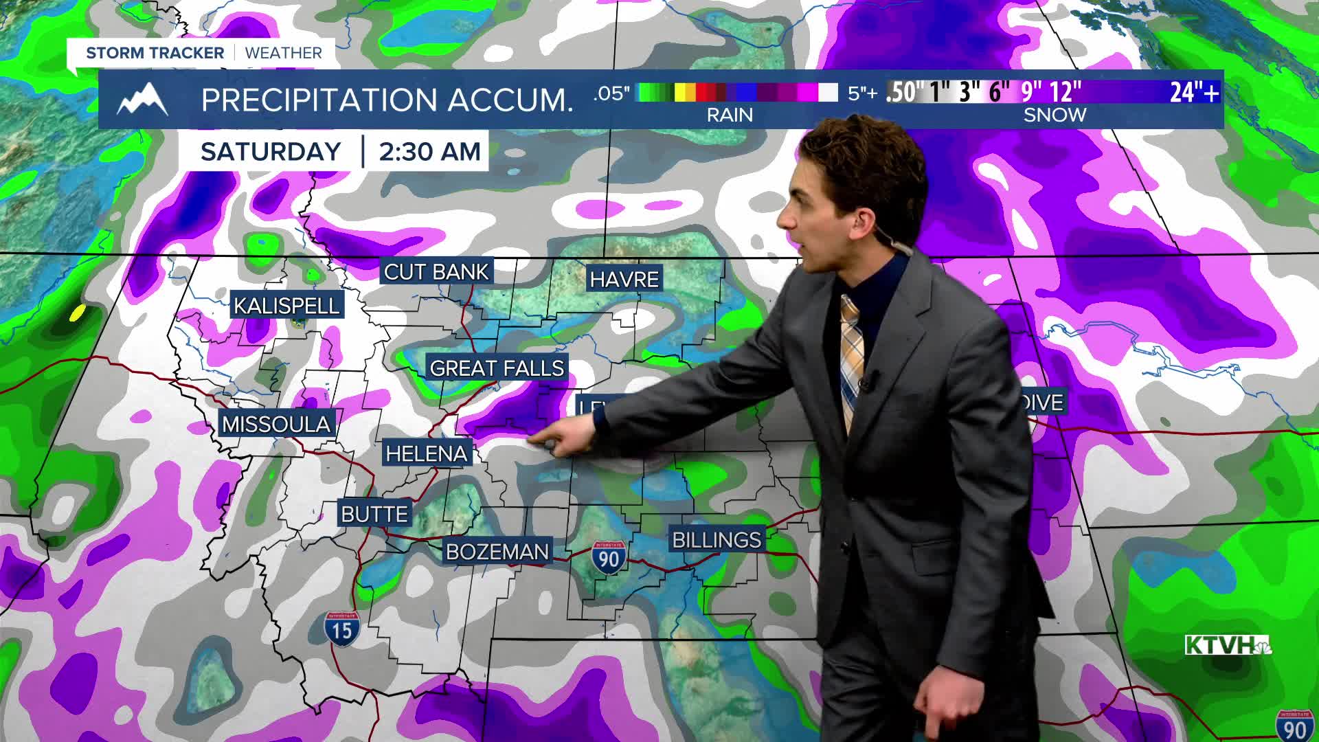
LONG-RANGE FORECAST: Colder and generally unsettled conditions will stick around through the weekend.
——————————————————————————————————————————
WEATHER ALERTS:
NONE
——————————————————————————————————————————
Helena Temperature Records Today:
High: 85 (1980)
Low: 3 (1927)
AVG: 58/33
Great Falls Temperature Records Today:
High: 89 (1980)
Low: -1 (2008)
AVG: 56/31


