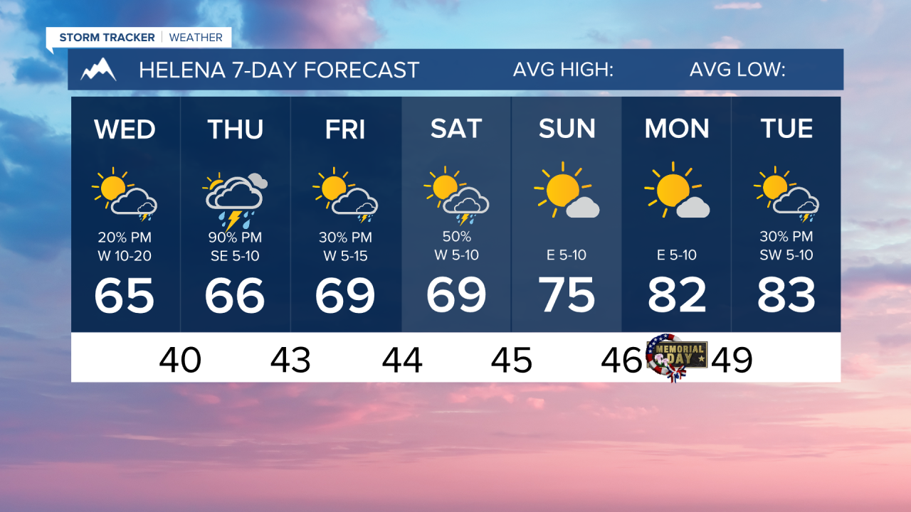
It was a cold morning as the skies were clear over western Montana, allowing traditional cooling to take effect. The Helena valley was a cold as 30°. Luckily, temperatures will warm rapidly back into the low to mid-60s for highs statewide
Scattered showers and thunderstorms will develop this afternoon, mainly in the northern plains. A stray shower may be near Helena, but a mainly dry day should be expected.
More thunderstorm activity will be prevalent over southwest Montana tomorrow as a small weather system moves towards the northeast. A few of these storms could be on the stronger side and produce some heavy downpours. These showers and storms will move into north-central Montana in the nighttime hours.
Another center of low passes to the south through the holiday weekend. Most of the moisture should stay south on I-90 on Friday and Saturday, but a few isolated showers and storms are possible north of that line. Temperatures warm into the 70s by Sunday. Showers and storms reach further north in the plains on Sunday, but the Helena and Great Falls areas will be dry.
A ridge of high pressure continues to build into next week, allowing highs to reach well into the 80s.
——————————————————————————————————————————
WEATHER ALERTS:
NONE
——————————————————————————————————————————
Helena Temperature Records Today:
High: 89 (1980)
Low: 27 (2021)
AVG: 68/43
Great Falls Temperature Records Today:
High: 93 (1980)
Low: 24 (2022)
AVG: 66/40
Have a great Wednesday!
Joey Biancone
Meteorologist