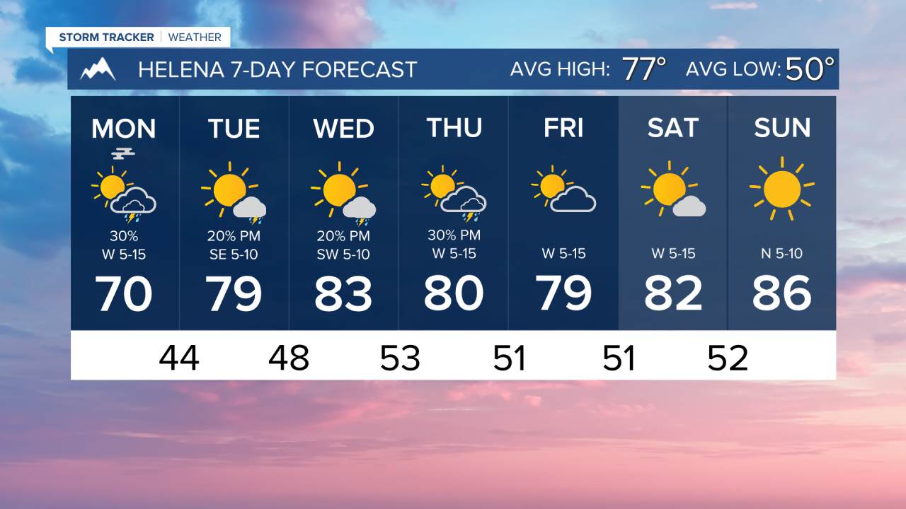


After a very wet, cold, and even snowy weekend, we begin to warm back up towards normal temperatures today. Frost and fog are possible this morning, but temperatures warm rapidly back into the upper 60s to low 70s. A few showers and thunderstorms will form along the Continental Divide this afternoon.
Tomorrow will be a mostly dry day, aside from a couple of afternoon showers in southwest Montana and a few thunderstorms in the southeastern corner of the state. Highs warm into the upper 70s to low 80s. Wednesday will be a similar day.
A cold front moves in on Thursday, giving us our best rain and thunderstorm chances of the week. A few of these storms could be strong. Highs will reach the 80s.
The weekend will be mainly dry with highs in the upper 70s to low 80s. By next week, high temperatures could reach the 90s.
——————————————————————————————————————————
WEATHER ALERTS:
NONE
——————————————————————————————————————————
Helena Temperature Records Today:
High: 98 (1941)
Low: 35 (1997)
AVG: 77/50
Great Falls Temperature Records Today:
High: 101 (1936)
Low: 35 (1905)
AVG: 75/47
Have a great weekend!
Joey Biancone
Meteorologist