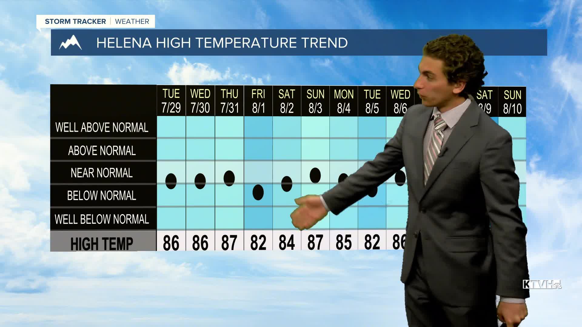


After several weeks of cooler and stormier weather, a brief period of warmer and drier weather is on the way.
At least for today, a weak cold front will push southward into north-central Montana. A few showers and storms may form, but most of the area will stay dry. Highs in the plains will range from the upper 70s to low 80s, while the valleys of western Montana will reach the 80s and low 90s.
The front's influence dissipates tomorrow, giving way to warmer air surging back into the state when highs will reach the upper 80s to low 90s. Outside of a few thunderstorms popping up in the Beartooth Mountains, the state will be dry.
Wednesday will be the hottest day, with highs in the state ranging from the low to mid-90s.
Another cold front is expected to arrive from the north on Thursday, bringing cooler air and minimal precipitation.
Towards the end of the week, isolated thunderstorms will form in southwestern Montana.
——————————————————————————————————————————
WEATHER ALERTS:
A LAKE WIND ADVISORY has been issued for Fort Peck Lake from 11 AM Monday until 8 PM Monday
——————————————————————————————————————————
Helena Temperature Records Today:
High: 98 (2018)
Low: 40 (1997)
AVG: 87/54
Great Falls Temperature Records Today:
High: 101 (1996)
Low: 37 (1893)
AVG: 85/52
Have a great start to the week!
Joey Biancone
Meteorologist


