


Halloween is shaping up to be a boo-tiful day, with highs in the 50s and little wind. That will change heading into the night, as a frightful wind will blow the ghosts into North Dakota throughout the weekend!
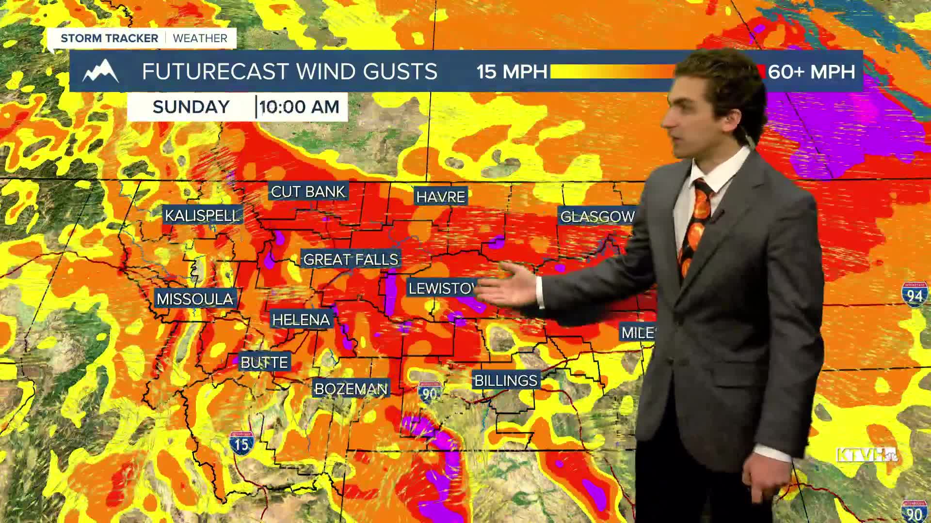
All puns aside, we are tracking another high wind event for much of the state. High wind watches have been issued for Saturday and Sunday, and even one near the Cut Bank area after dark tonight.
Wind gusts along the Rocky Mountain Front can approach 80 MPH again. Much of north-central Montana will feel gusts exceeding 60 MPH. The Helena area will not be windy for most of the day on Saturday. We will see the wind pick up Saturday night into Sunday.
The wind on Saturday will push most locations near daily record-high temperatures.
A quick reminder that we fall back on Sunday morning. Make sure to set your clock back one hour before heading to bed on Saturday night. We do gain an hour of sleep, but the new sunset time will come just after 5 PM.
An overall ridging pattern builds in next week, but a few storm systems moving along the ridge axis will keep some cloud cover, wind, and isolated rain chances around.
——————————————————————————————————————————
WEATHER ALERTS:
A HIGH WIND WATCH has been issued for Eastern Glacier, Western Toole, and Central Pondera Counties for Friday evening
A HIGH WIND WATCH has been issued for Eastern Glacier, Western Toole, and Central Pondera Counties from Saturday afternoon through Sunday afternoon
A HIGH WIND WATCH has been issued for the East Glacier Park Region, the Northern High Plains, the Southern Rocky Mountain Front, and the Southern High Plains from Saturday afternoon through Sunday afternoon
A HIGH WIND WATCH has been issued for the Big Belt, Bridger, and Castle Mountains from Saturday afternoon through Sunday afternoon
A HIGH WIND WATCH has been issued for Eastern Toole and Liberty Counties, Hill County, Northern Blaine County, Eastern Pondera and Eastern Teton Counties, Western and Central Chouteau County, Bears Paw Mountains and Southern Blaine County, Cascade County below 5000ft, Judith Basin County and Judith Gap, Fergus County below 4500ft, Little Belt and Highwood Mountains, and the Snowy and Judith Mountains from Saturday afternoon through Sunday afternoon
A HIGH WIND WATCH has been issued for the Madison River Valley, including Norris Hill on Highway 287 from Saturday afternoon through Sunday afternoon
——————————————————————————————————————————
Helena Temperature Records Today:
High: 68 (1967)
Low: -5 (1935)
AVG: 50/28
Great Falls Temperature Records Today:
High: 72 (2014)
Low: -9 (2002)
AVG: 50/28


