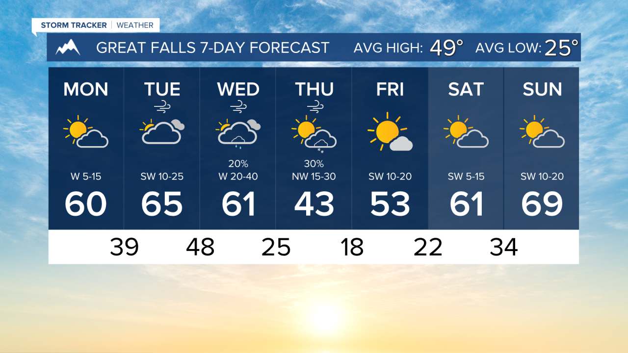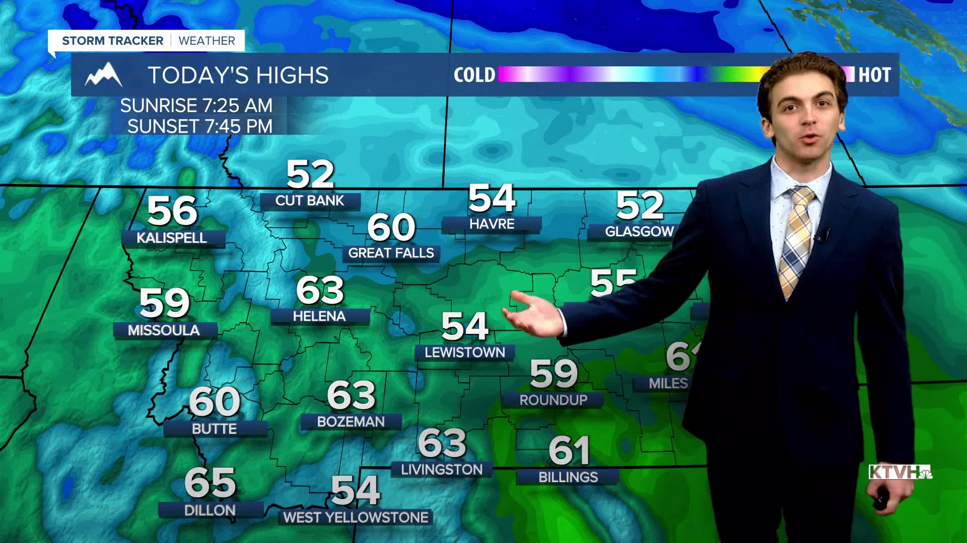


MONDAY, MARCH 23RD: If you enjoyed Sunday's weather, you are really going to enjoy today's forecast. Highs will reach the 50s and 60s under partly cloudy skies. Winds will remain light, around 5 to 15 MPH. See the post below for wildfire updates from over the weekend.
TUESDAY, MARCH 24TH: Isolated rain showers will move through in the morning over the higher terrain of central Montana along a warm front. Temperatures will continue to warm into the 60s by the afternoon with mostly cloudy skies.
A center of low pressure will begin to form in north-central Montana on Tuesday evening. This, combined with a strong mid-level jet, will cause the surface winds to increase once again. Wind will gust around 20-30 MPH before midnight.
A cold front moving into western Montana on Tuesday afternoon will bring scattered rain showers to the mountains, with snow in the very high peaks.
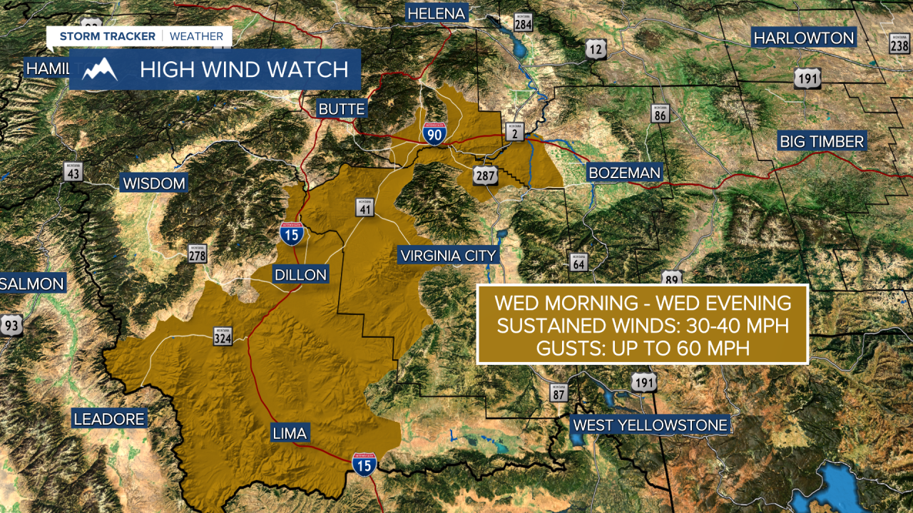
WEDNESDAY, MARCH 25TH: We expect widespread gusty winds with the aforemention low pressure system strengthening during the day. Gusts raining from 40-60 MPH are likely for lower elevations. However, this will not be as strong as the March 8th or March 12th windstorms.
Light lower elevation rain will initially move into the Helena area early Wednesday afternoon. We may see a few wet snowflakes mix in by Wednesday night, but don't expect snow to accumulate.
Temperatures will reach the 60s before cooling down in the afternoon after the cold front passes over.
THURSDAY, MARCH 26TH: Winds will not be as strong as on Wednesday, but most areas will remain breezy. Gusts can reach near 30-40 MPH. An isolated snow shower develops in the afternoon due to instability. Highs will only reach the 40s.
LONG-RANGE FORECAST: Expect cold mornings on Friday and Saturday with lows dipping to the teens and 20s. Temperatures rebound quickly over the weekend, with some areas close to the low 70s by Sunday.
——————————————————————————————————————————
WEATHER ALERTS:

——————————————————————————————————————————
Helena Temperature Records Today:
High: 74 (1993)
Low: -10 (1984)
AVG: 50/27
Great Falls Temperature Records Today:
High: 74 (1993)
Low: -15 (1964)
AVG: 49/25