


Wind will pick up for most of the state today and Friday. Gusts up to 65 MPH are possible near the Hi-Line. The Helena Valley will experience windy conditions, with gusts ranging from 30 to 40 MPH.
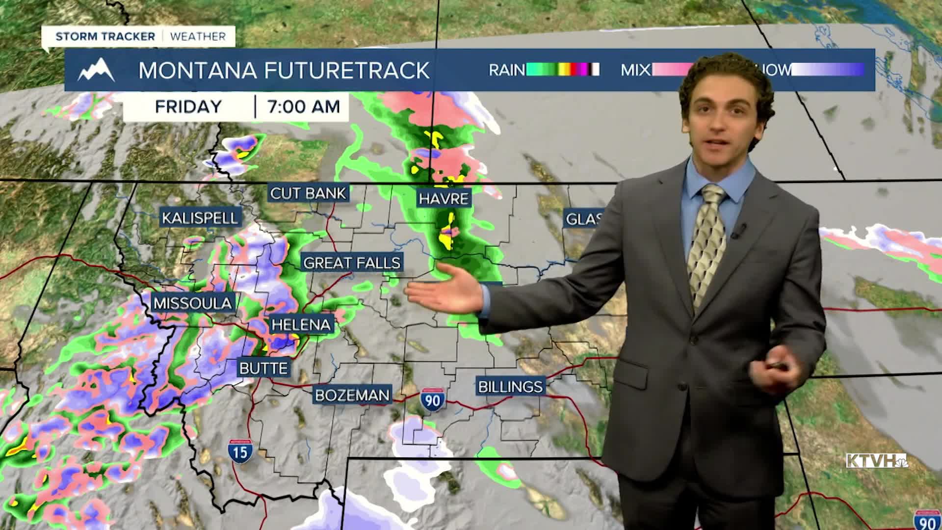
Another cold front will bring scattered showers on Friday morning. A brief burst of rain and snow is possible around 6-7 AM in Helena. Mountain snow showers will stick around most of the day. Some light snow may move into the plains early Saturday morning.
The weekend will feature less wind and rain, with slightly cooler temperatures. Highs will only reach the 40s on Saturday and the 50s on Sunday. Overnight lows dip into the 20s.
A ridge of high pressure builds over the western United States at the beginning of next week. This will allow warmer and drier conditions to take hold.
——————————————————————————————————————————
WEATHER ALERTS:
A HIGH WIND WARNING continues for Eastern Glacier, Western Toole, and Central Pondera Counties until 6 PM Thursday
A HIGH WIND WARNING continues for Southwest Phillips County until 5 PM Thursday
A LAKE WIND ADVISORY continues for Fort Peck Lake until midnight Thursday
A WIND ADVISORY continues for the Beartooth Foothills and Livingston Area until noon Friday
A HIGH WIND WATCH has been issued for the Bears Paw Mountains and Southern Blaine, Fergus County below 4500ft, and Northern Blaine County from Friday afternoon until early Saturday morning
——————————————————————————————————————————
Helena Temperature Records Today:
High: 69 (2006)
Low: 1 (1971)
AVG: 47/26
Great Falls Temperature Records Today:
High: 72 (2010)
Low: -13 (1971)
AVG: 47/26


