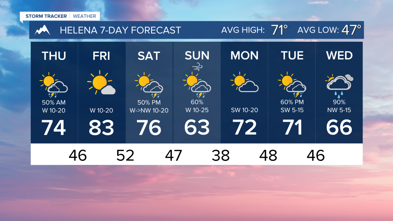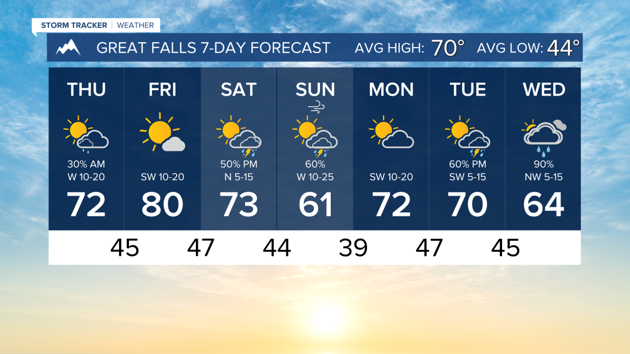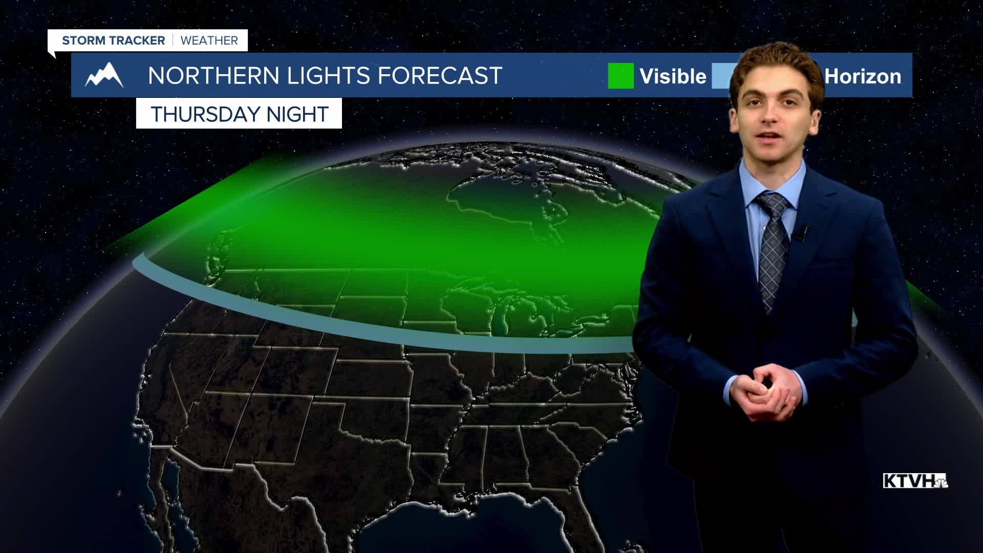


THURSDAY, JUNE 4TH: Another small disturbance moved through western Montana, only bringing light rain showers and a few rumbles of thunder. Conditions will be drier through western and central Montana by the afternoon, but eastern Montana will be dealing with strong to severe thunderstorms.
High temperatures will reach the 60s and 70s again with clearing skies.
Expect this afternoon to be breezy with winds 10-20 MPH out of the west. Gusts may approach 30 MPH at times.
FRIDAY, JUNE 5TH: It will be a beautiful day with highs in the upper 70s to low 80s under mostly sunny skies.
Expect the afternoon to be breezy once again, with winds 10-20 MPH out of the west. Gusts may approach 30 MPH at times.
SATURDAY, JUNE 6TH: A cold front will begin to move through the state, bringing afternoon thunderstorms to the area. High temperatures will range from the 60s in western Montana to the 90s in eastern Montana. The Helena area will reach a high in the 70s. Expect partly cloudy skies with winds around 10-20 MPH.
SUNDAY, JUNE 7TH: Rain showers and a few thunderstorms will continue to impact the area. Rain totals will not be as impactful as the past weekend's storm. A little bit of mountain snow cannot be ruled out with this system. Highs will only reach the 50s and 60s. Winds may gust near 20 to 30 MPH at times.
LONG-RANGE FORECAST: We stay in an overall active pattern into next week, but no widespread precipitation is expected until at least Wednesday of next week.
——————————————————————————————————————————
WEATHER ALERTS:
NONE
——————————————————————————————————————————
Helena Temperature Records Today:
High: 97 (1988)
Low: 31 (1998)
AVG: 71/47
Great Falls Temperature Records Today:
High: 95 (1988)
Low: 32 (1998)
AVG: 70/44