


After three straight days of record-setting high temperatures across the state, a cold front begins to move in, bringing some colder, more January-like weather by Friday.
THURSDAY, JANUARY 15th: A Canadian cold front will begin moving through the state this morning. Temperatures will "only" reach the 40s and low 50s for most of the state before plummeting into the teens and 20s by tomorrow morning. An isolated snow shower or two is possible once north winds meet the Rocky Mountain Front, Big Belt, and Little Belt mountains later this afternoon. Accumulation will have almost no impact in our region of the state.
Elsewhere in eastern Montana, High Wind Warnings have been issued. Wind gusts can approach 60-75 MPH in the eastern half of the state this afternoon and evening. It will not be as windy near the Rocky Mountain Front, but a localized downslope wind will be present in Helena through the morning and into the early afternoon, with gusts reaching around 30 MPH.
A brief period of snow is possible in the eastern plains along the cold front. Some blowing snow may impact road conditions overnight in that region.
FRIDAY, JANUARY 16th: This will be an overall colder day, feeling more like January. Highs will only reach the 30s for most of the state. Expect partly to mostly sunny skies with lighter winds in Helena. Winds will still be gusty in the central and eastern plains at times. Wind chill values in eastern Montana will be approaching the single digits and teens below zero.
SATURDAY, JANUARY 17th: Morning temperatures will be quite cold for a lot of the state, dipping into the teens for most. Highs will warm back above average for north-central Montana with a downslope wind picking up off the Rocky Mountain Front. Highs reach the mid to upper 40s for most of the region. Helena will be in a temperature inversion, so temperatures may only reach the low 40s.
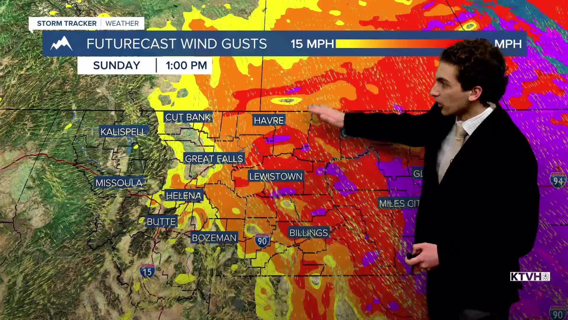
SUNDAY, JANUARY 18th: Another cold front from the north will come through the state. This is a very similar setup to today's front. Wind east of Interstate 15, colder temperatures, and isolated snow showers near the mountains. Highs will only reach the 20s and 30s.
LONG-RANGE FORECAST: Colder air and some precipitation may return by the middle of next week.
——————————————————————————————————————————
WEATHER ALERTS:
A HIGH WIND WARNING has been issued for Eastern Toole and Liberty Counties, Hill County, Northern Blaine County, Bears Paw Mountains and Southern Blaine, Judith Basin County and Judith Gap, and Fergus County below 4500ft from noon Thursday until 5 AM Friday
A HIGH WIND WARNING has been issued for Central and Southeast Phillips, Northern Phillips, Petroleum, and Southwest Phillips Counties from 11 AM Thursday until 5 PM Friday
A HIGH WIND WARNING has been issued for northeast Montana from 11 AM Thursday until 5 PM Friday
A HIGH WIND WARNING has been issued for Judith Gap and Southern Wheatland County from 11 AM Thursday until 5 PM Friday
A HIGH WIND WARNING has been issued for Rosebud County from noon Thursday until 5 PM Friday
A HIGH WIND WARNING has been issued for Southern Big Horn County from noon Thursday until 5 PM Friday
A HIGH WIND WARNING has been issued for Musselshell County from noon Thursday until 5 PM Friday
A HIGH WIND WARNING has been issued for Carter, Custer, Fallon, and Powder River Counties from noon Thursday until 5 PM Friday
——————————————————————————————————————————
Helena Temperature Records Today:
High: 58 (1974)
Low: -41 (1888)
AVG: 32/13
Great Falls Temperature Records Today:
High: 60 (1973)
Low: -32 (2024)
AVG: 35/15


