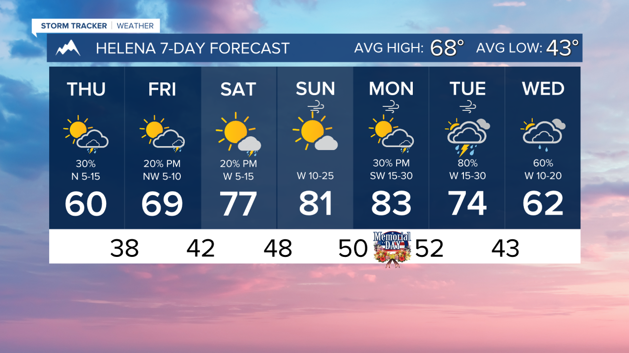


THURSDAY, MAY 21ST: Isolated rain showers stick around early this morning, but we should expect this storm system to move out into eastern Montana by the afternoon. A stray shower or thunderstorm may pop up this afternoon, but most areas stay dry. High temperatures will reach the upper 50s to low 60s under partly cloudy skies.
FRIDAY, MAY 22ND: Most areas will be mostly clear to partly cloudy with highs in the 60s and low 70s. An isolated shower or thunderstorm over the mountains is possible. It will be a beautiful day with warm, mostly dry conditions and light winds.
SATURDAY, MAY 23RD: Temperatures will continue to warm with highs in the 70s for most lower elevations across the state. There may be a couple of showers and thunderstorms, but overall dry conditions for most under mostly sunny to partly cloudy skies. Winds will be out of the southwest at 5 to 15 MPH.
SUNDAY, MAY 24TH A great day to be outside. Highs reach the 70s and 80s under mostly sunny skies. A bit of wind will pick up in the afternoon, with gusts reaching around 30 MPH.
LONG-RANGE FORECAST: Warmer and drier conditions continue over the weekend and into early next week. While we will have lighter winds through the workweek, gusty conditions pick up over the second half of Memorial Day Weekend. Thunderstorms will return to the area by Tuesday of next week
——————————————————————————————————————————
WEATHER ALERTS:


——————————————————————————————————————————
Helena Temperature Records Today:
High: 90 (2002)
Low: 28 (2021)
AVG: 68/43
Great Falls Temperature Records Today:
High: 94 (1897)
Low: 26 (2021)
AVG: 66/40