It's going to be a great weekend to get outdoors and enjoy everything our great state has to offer. Aside from some spotty showers and storms, partly cloudy skies and warm temperatures dominate the region.
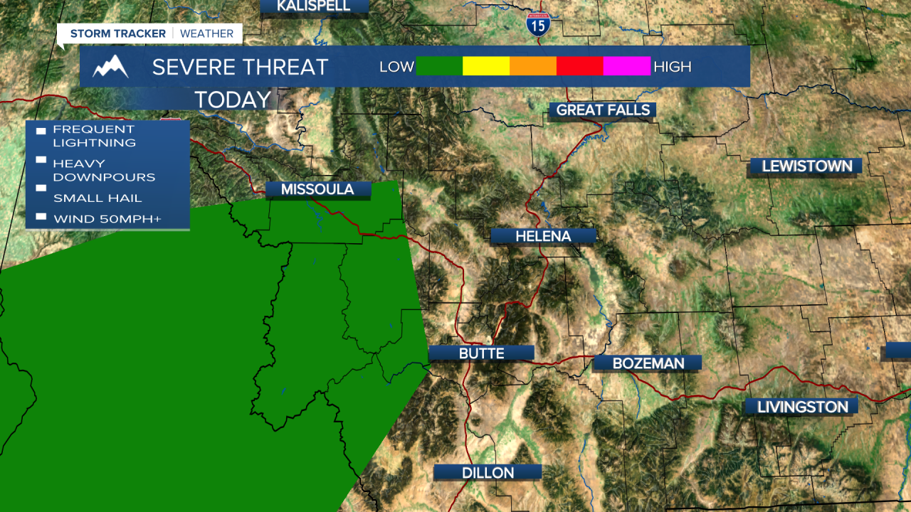
There is a level 1/5 (marginal) severe threat for portions of southwest Montana today. This includes areas like Missoula, Hamilton, and Philipsburg. The threat is mainly for some gusty wind, but we cannot rule out an isolated cell or two producing small hail. Storms will start to fire along the MT-ID border in the early afternoon hours. They will progress northeastward through the state through the rest of the day today and in the early AM hours tomorrow.

We will be very warm and mostly dry tomorrow. The thermometers will read in the upper 60s to mid 70s for much of the state. Partly cloudy skies are to be expected. There is a small chance of some pop up thunderstorms and showers in the southwest once again, but they should only affect the mountainous regions.
Sunday is the same story as Saturday. Temperatures 15-20 degrees above average with the chance of some afternoon thunderstorms in the mountains.
A cold front will advance through portions of the state on Monday, bringing some rain and scattered thunderstorms. We will start to cool behind the front as temperatures will "only" be in the 60s.

We will approach almost record highs over the weekend and then almost the coldest highs on record by the middle of next week. A cut off low to our south will merge with the low to our north in Canada to bring much colder and more unsettled conditions to the region on Tuesday through Thursday. Confidence is increasing for accumulation snow throughout the state. The highest snow totals will be in the mountains. There is still uncertainly of how much snow lower elevations will get, as we will have a warm ground temperatures.

Helena Temperature Records Today:
High: 77° (1949)
Low: 6° (1881)
AVG: 56/31
Great Falls Temperature Records Today:
High: 77° (1976)
Low: -3° (2020)
AVG: 54/29
Have a great weekend!
Joey Biancone
Meteorologist
Facebook: Meteorologist Joey Biancone
Instagram: joeybianconewx


