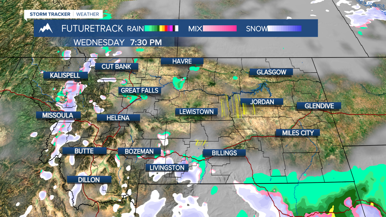
A WINTER WEATHER ADVISORY is in effect for the Big Belt Mountains, Castle Mountains, Bridger Mountains, and the mountains of southern Montana through Wednesday evening.
Showers of rain and snow and even a few thunderstorms have been moving through the state and there will be another unsettled day before things dry out and warm up.
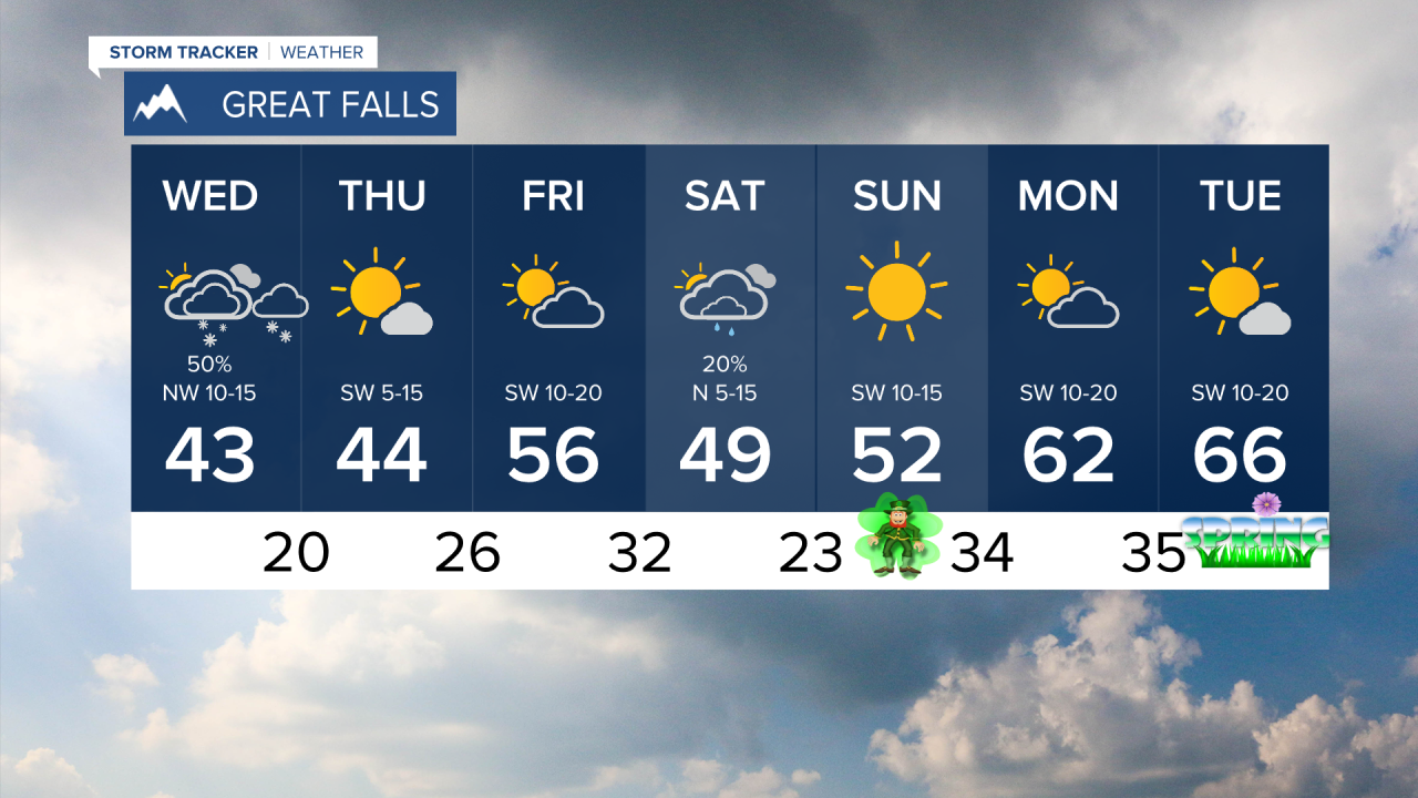
Active weather will produce scattered showers of rain and snow in the lower elevations with accumulating snow mainly confined to the mountains. Wednesday will be a little cooler with highs in the 30s and 40s, cold enough for a little light snow shower activity in the lower elevations. Any accumulation will be light, but the mountains will have the chance at seeing a few more inches accumulate. Thursday will be mostly sunny with a few lingering snow showers mainly over the mountains. High pressure will build in for clearing skies and light wind. Highs will be in the 40s. Lows will drop into the 10s and 20s. Friday will be partly cloudy and warmer with highs up in the 50s. This weekend is the final weekend of winter officially and a weak cold front will pass through on Saturday with partly to mostly cloudy and a few isolated showers. Any accumulation will be confined to the mountains. Highs will be in the 40s and 50s. Sunday is St. Patrick's Day and by the luck o' the Irish, it will be a beautiful day with sunshine and highs in the 50s. The first day of Spring is Tuesday, which could begin with one of the warmest days so far in 2024. Are you ready for the 60s?
Have a great day,
Curtis Grevenitz
Chief Meteorologist


