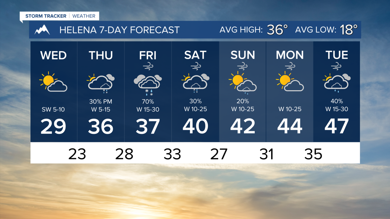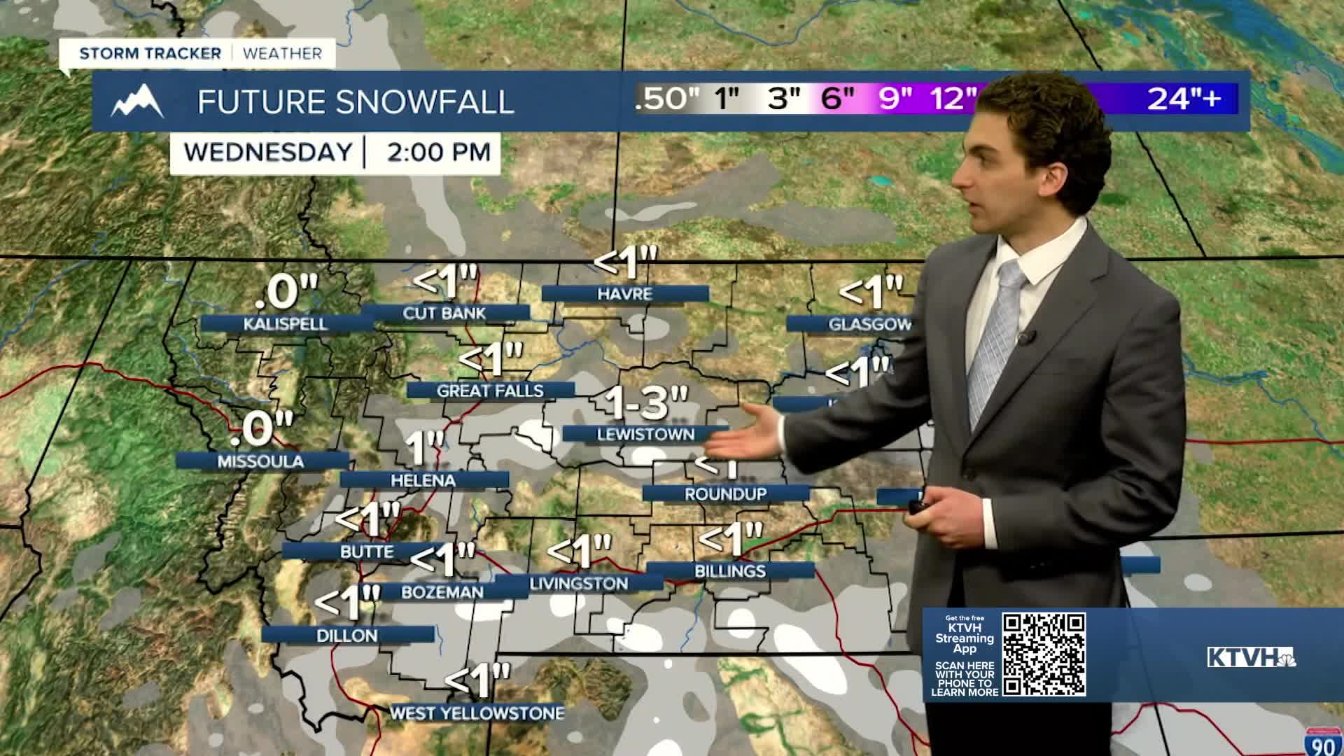


Light snow continues this evening around the Helena area. We will start to dry out overnight. Temperatures drop into the teens and twenties by tomorrow morning, which will create patches of ice on roads.
Some fog may develop within the Helena valley. A temperature inversion will set in for tomorrow. Wind will stay on the lighter side through most of the day, but it will eventually pick up on Thursday afternoon.
The wind will remain gusty through most of the week near the Continental Divide. The Rocky Mountain Front will feel the strongest winds approaching 50 MPH.
The wind will keep temperatures near to slightly above average this week. Highs will be in the 30s and 40s for most of the state.
Another round of wintry weather will come through the state on Friday. It's looking like this will mainly produce impactful mountain snow through southwestern Montana. Valleys and the plains will see a rain/snow mix. Significant accumulation is not expected in lower elevations at this time.
——————————————————————————————————————————
WEATHER ALERTS:
A WINTER WEATHER ADVISORY continues for Fergus County Below 4500 feet until 5 AM Wednesday
A WINTER WEATHER ADVISORY continues for Northwest Beaverhead County until 11 PM Tuesday
A WINTER WEATHER ADVISORY continues for the Continental Divide along the Rocky Mountain Front until 11 PM Tuesday
A WINTER WEATHER ADVISORY continues for Treasure, Custer, and Northern Rosebud Counties until 11 PM Tuesday
A WINTER WEATHER ADVISORY continues for Bears Paw Mountains and Southern Blaine, Cascade County below 5000ft, Judith Basin County and Judith Gap, Fergus County below 4500ft, Upper Blackfoot and MacDonald Pass, Gates of the Mountains, and the Helena Valley until 5 AM Wednesday
A WINTER WEATHER ADVISORY continues for the Elkhorn and Boulder Mountains until 5 AM Wednesday
A WINTER WEATHER ADVISORY continues for the Highwood, Little Belt, Judith, and Snowy Mountains, Big Belt, Bridger and Castle Mountains, and Gallatin and Madison County Mountains and Centennial Mountains until 5 AM Wednesday
A WINTER WEATHER ADVISORY continues for Northern Big Horn, Southern Big Horn, Carter, Powder River, and Southern Rosebud until 5 AM Wednesday
A WINTER WEATHER ADVISORY has been issued for Pryor/Northern Bighorn Mountains from 11 AM Tuesday until 5 AM Wednesday
A WINTER WEATHER ADVISORY has been issued for Beartooth Foothills and Red Lodge Foothills from 5 PM Tuesday until 5 AM Wednesday
A WINTER WEATHER ADVISORY has been issued for the Bighorn Canyon from 5 PM Tuesday until 5 AM Wednesday
——————————————————————————————————————————
Helena Temperature Records Today:
High: 64 (2021)
Low: -25 (1985)
AVG: 36/18
Great Falls Temperature Records Today:
High: 60 (2021)
Low: -28 (1985)
AVG: 38/19