


FRIDAY, MARCH 6TH: With a smaller disturbance working its way through the state late tomorrow morning and into the afternoon, scattered mountain snow showers will form with very light lower elevation rain. Highs will reach the 40s and low 50s with partly cloudy skies.
Winds will continue to slightly increase in the plains, with gusts around 50 MPH near the Rocky Mountain Front. Winds in Helena will be around 5-15 MPH. Winds in Great Falls will reach around 20-30 MPH.
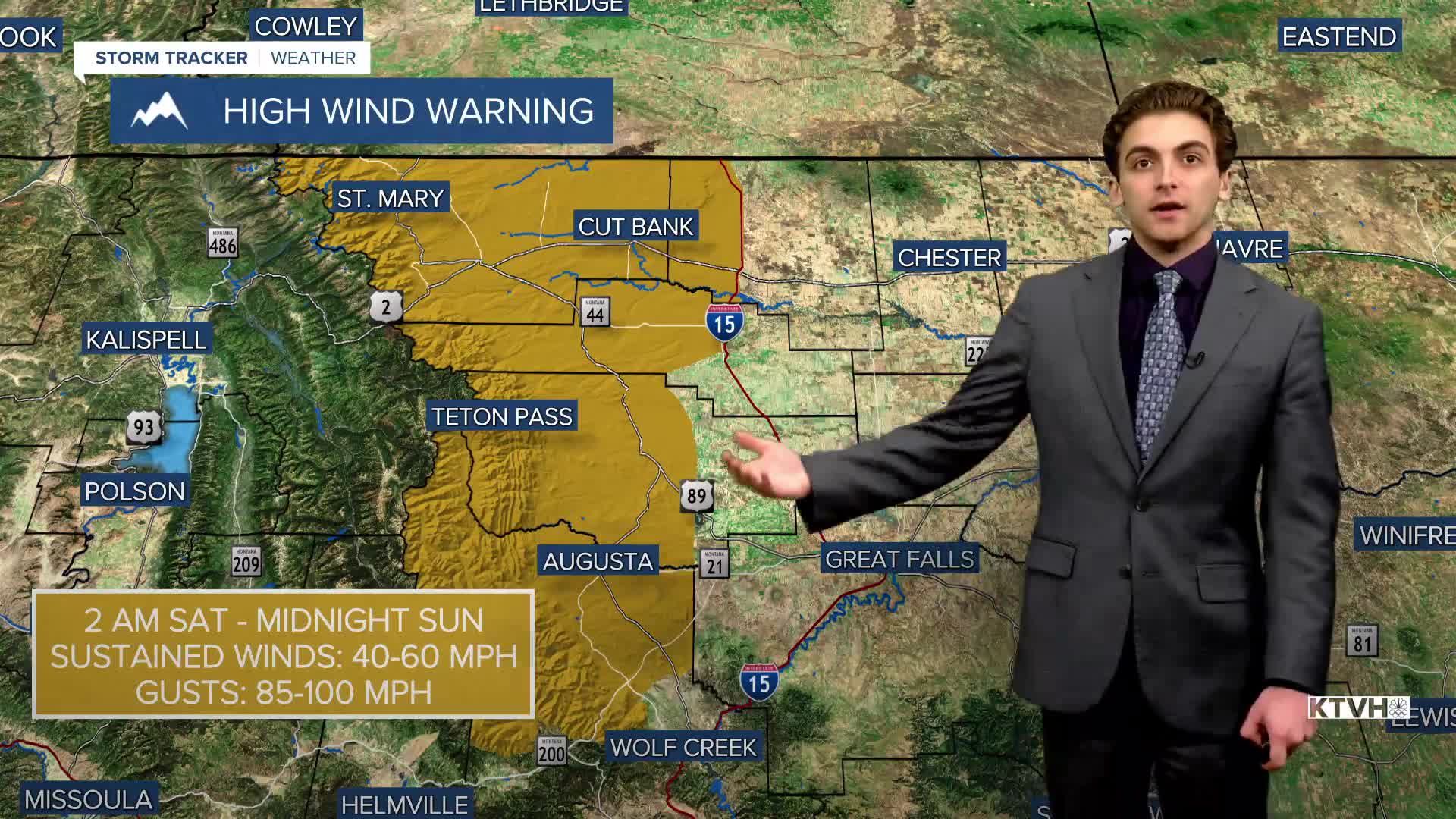
SATURDAY, MARCH 7TH: A couple of showers will come through in the mountains early Saturday morning. Winds significantly increase. Gusts near the Rocky Mountain Front will approach 85-100 MPH. It will be windy for mostly lower elevations. Winds will push temperatures back up into the 50s and 60s for most. Be prepared for dangerous travel throughout the state for most of the weekend with strong crosswinds.
SUNDAY, MARCH 8TH: Similar to Saturday, widespread gusty winds are expected throughout Big Sky County. The winds will be stronger throughout the lower elevations of central Montana, including the usually wind-protected valleys. Chinook winds will warm most areas into the low 60s.
A cold front approaching from the north will bring rain and snow back into the state beginning Sunday afternoon.
MONDAY, MARCH 9TH: Winds will decrease below High Wind Alert criteria on Monday, but remain active. Rain will convert to snow as the cold front continues to push south. Highs will only reach the 30s and 40s.
LONG-RANGE FORECAST: We are looking at several periods of scattered rain and snow early next week, with near-normal temperatures expected.
——————————————————————————————————————————
WEATHER ALERTS:


——————————————————————————————————————————
Helena Temperature Records Today:
High: 70 (2020)
Low: -20 (1920)
AVG: 44/22
Great Falls Temperature Records Today:
High: 70 (2020)
Low: -24 (1952)
AVG: 43/19


